Dr Jamin Greenbaum and the team are working at the front line of climate change on the coldest continent on Earth.
Dr Greenbaum, a geophysicist at the Scripps Institution of Oceanography, and his team want to understand what is driving Antarctic Ice Sheet melt and how to better predict global rising sea levels.
They are looking for fresh evidence to support the idea that meltwater flowing out to sea from Antarctic glacial ice shelves might be contributing to warmer oceans and accelerated ice loss.

Dr Greenbaum and his team want to understand what is driving Antarctic Ice Sheet melt and how to better predict global rising sea levels.
Plumbing the depths of Antarctic coastlines to predict subglacial melt
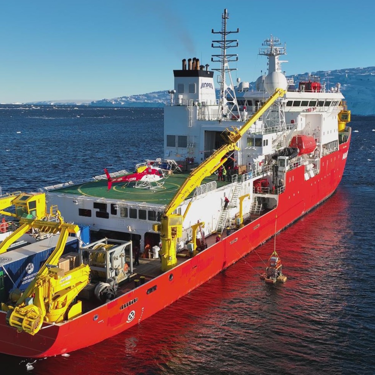
Antarctica from above is like nowhere else on Earth. But its floating ice shelves, exposed to both warm air above and the ocean below, are the most susceptible to melt.
“Antarctic melt has the potential to raise global sea levels by about 58 metres if the entire ice cap melted into the ocean. The last time global average temperatures were similar to today, Antarctica likely contributed between 3 and 6 metres above present sea level,” said Dr Greenbaum.
To put that in perspective, a 1 metre sea level rise would directly impact more than 145 million coastal communities worldwide.
Innovative techniques to observe and understand glaciers
While a traditional method involves using satellites to monitor ground lines (locations where a glacier begins to float and form an ‘ice shelf’ instead of resting on the ocean floor), Dr. Greenbaum and the research team opted for an alternative approach.
“Directly observing these environments is tough, expensive, and spatially limited. You can use autonomous underwater vehicles beneath some areas of ice shelves or you can set up hot water drilling camps in others. But these methods still don’t allow full exploration of the environments,” he said.
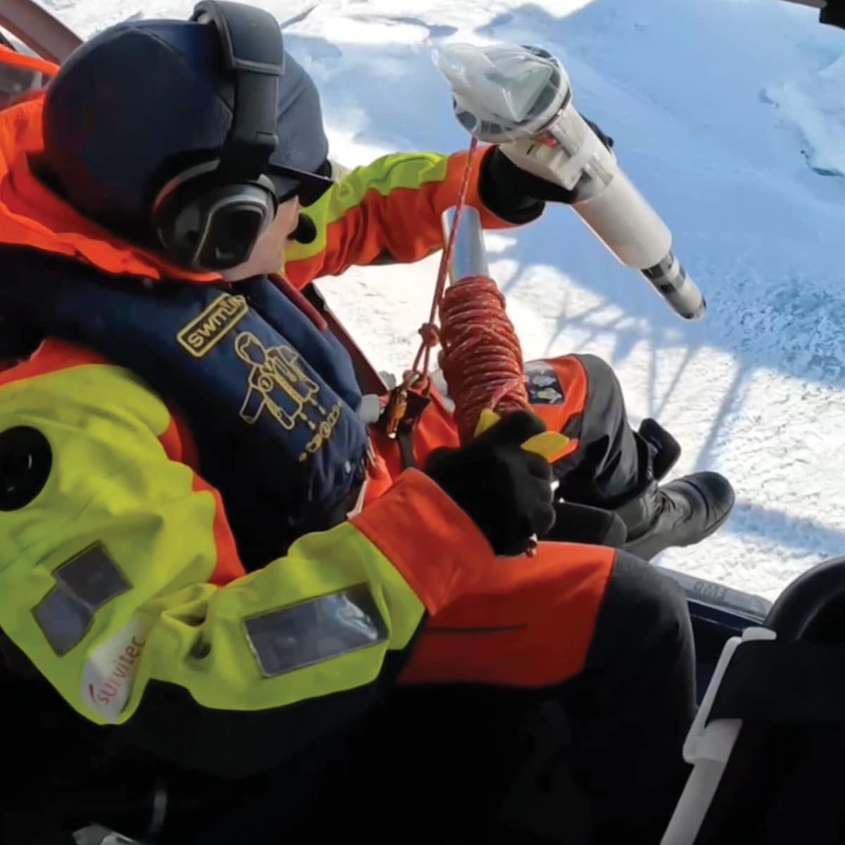
Together with a crew from Canadian Helicopters, the team used the unconventional method of deploying specialist sensors from the air into small gaps in the ice.
“Our mission’s target areas are close to the grounding line, where fractures allow us to access the ocean if we can break through thin layers of sea ice,” said Dr Greenbaum.
“These spots are too far for autonomous vehicles to reach from the open ocean and where drilling camps are too risky. Using aircraft enables us to collect critical gravity and magnetic field data to help more accurately infer seafloor depth in these otherwise inaccessible areas.”
Ice loss
Antarctic glacial ice shelves might actually be contributing to warmer oceans and accelerated ice loss.
58 metres
Antarctic melt has the potential to raise global sea levels by about 58 metres if the entire ice cap melted.
145 million
A 1-metre sea level rise would directly impact more than 145 million coastal communities worldwide.
An ice-locked continent swings from natural wonder to global threat
When Antarctica was first discovered over 200 years ago it was considered a natural wonder. Advancements in geophysical technology in the 1950’s and 60’s enabled the detection of huge ice sheets grounded 2.6 km below the sea in West Antarctica.
But it was the 1970’s Marine Ice Sheet Instability hypothesis that first floated the idea that ice sheets grounded below sea level could potentially destabilise quickly.
Warm ocean water discovered in the 1990s near the glacier represented a possible trigger for runaway marine ice melt. However, recent research shows the ocean on its own may not be warm enough to cause this. Dr Greenbaum and his team are determined to find the missing puzzle piece.
Assisting them in their research is Seequent’s innovative subsurface software that pulls together the huge amounts of data captured across multiple geological and geophysical surveys.

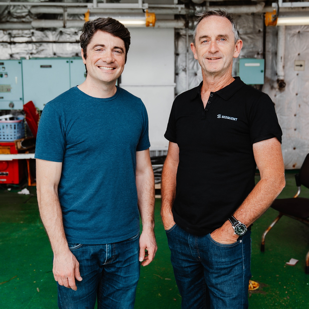
Dr. Jamin Greenbaum discusses with Seequent CEO, Graham Grant, their use of Oasis montaj for work and research. (Image: Seequent)
The value of visualising data to understand unseen ice vulnerability
Oasis montaj is an excellent platform for contextualising and interpreting various data types, such as gravity, magnetics, and radar, as well as for magnetic depth-to-basement inversions.
“Every year we rely on the software to help plan our surveys, create maps for pilots, design flight lines and grids of deployment to maximise our exploration time over the Antarctic summer months,” said Dr Greenbaum.
“We use previously acquired data to refine surveys, repeat lines, or hone in on the best locations to sink our ocean sensors. Sometimes we’re planning on the fly, depending on weather or circumstances beyond our control, so it’s very useful to have such an agile tool on hand.”
How UVA’s could advance Antarctic research techniques
Dr Greenbaum and the team understand that to gain a fuller picture of Antarctica and its vulnerabilities to global warming they’ll need to continue to make observations of glacial ice across the different seasons as well.
“… Antarctica’s infrastructure isn’t set up for wintertime science yet. There’s growing pressure from the science community to change that, and advancements in uncrewed aerial vehicles (UAV’s) should open up opportunities outside of summertime too.”
While the team is ramping up how to make the best use of UAV’s for their research, Oasis montaj will help with that. “It’ll be great to use Oasis montaj for planning those flights as well,” said Dr Greenbaum.
The team’s vital research is enabled with support from the National Science Foundation in the US, NASA, The Explorers Club through the generosity of Greg and Mary Moga, UC San Diego, and the G Unger Vetlesen Foundation.
Dr Jamin Greenbaum’s story has also been published in Eco Magazine’s April 2024 edition.