CHRISTCHURCH, NZ, 21 July 2020 – High-growth geoscience software company Seequent is accelerating the development of its cloud-based solution Seequent Central, enabling organisations to continue work on critical, large-scale, earth, environment, and renewable energy projects in the COVID-19 impacted environment.
Central works alongside Seequent’s other geoscience analysis, modelling, and collaborative technologies, to contribute understanding to subsurface geoscience and engineering design solutions. The cloud-based solution allows people in any location to visualise, track, and manage geological models created for infrastructure and critical services projects, in a centralised, auditable environment. A wide range of stakeholders can readily access highly visual up-to-date information to manage risk and make better environmental and investment decisions, to progress projects.
Seequent CEO, Shaun Maloney, says: “We’re working alongside customers to do everything we can to make it possible to meet the demands and operational challenges they may be facing in the current environment. In response to increased need and demand, we’re accelerating the development of Central to help our customers to continue to operate in interdependent and often remote work environments.”
Seequent’s software is being used on hundreds of diverse projects across the globe, ranging from infrastructure projects including large-scale rail, road and tunnel projects across North America, Europe, and Asia-Pacific; renewable energy projects in the US, Finland, Iceland, Indonesia, Philippines, and New Zealand; mining and exploration projects in North and South America, Africa, and Australia; and environmental projects such as groundwater management in North America, Europe, Africa, and Asia-Pacific. Projects include:
The Water Replenishment District – Groundwater management in Los Angeles
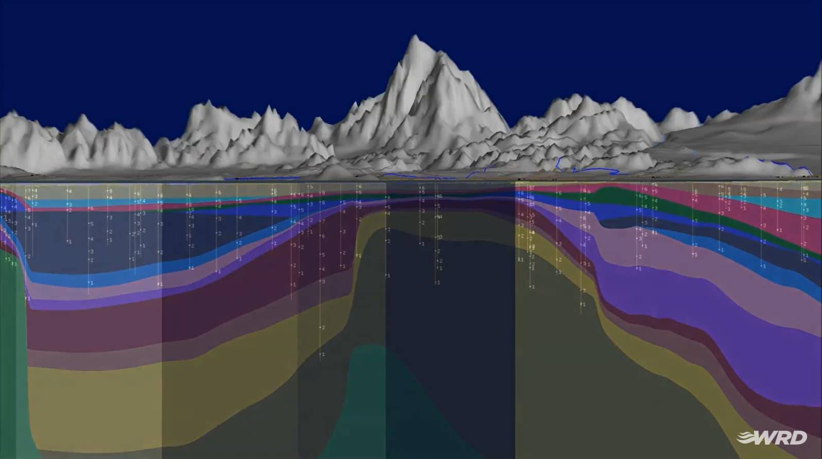
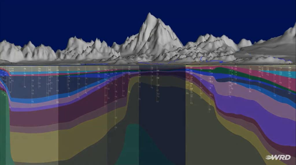
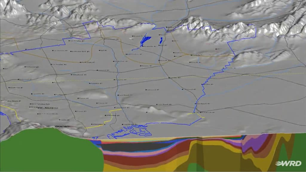
The Water Replenishment District (WRD), the largest groundwater agency in the State of California, has the important job of managing and protecting local groundwater resources for over four million residents. WRD’s service area covers a 420 square mile region of southern Los Angeles County, the most populated county in the United States. The 43 cities in the service area, including a portion of the City of Los Angeles, use about 250,000 acre‐feet (82 billion gallons) of groundwater annually which accounts for approximately half of the region’s water supply. Through WRD’s Water Independence Now Program, the district has become completely sustainable using local resources including advanced treated recycled water to replenish groundwater supplies.
To enhance management of these valuable water resources, the District has created a full 3D high resolution digital geologic and groundwater model of the Central and West Coast Basins (Basins). The model significantly advances their understanding of the groundwater flow systems and helps identify contaminated sites in both Basins. The District created a range of visually descriptive models in Seequent’s Leapfrog Works using extensive and diverse data sets that are regularly updated including – geologic, hydrogeologic, geophysical, groundwater contamination, well inventory (from 350 groundwater monitoring wells), seawater intrusion, and other types of data. The District’s team works together remotely on the same data in real-time with Seequent Central.
Brian Partington, Manager of Hydrogeology, WRD says the District can communicate with scientists, engineers, other staff and management, stakeholders and the general public with information they can readily understand and make decisions in real-time with Seequent’s highly visual solutions.
“WRD has enhanced support for its robust network of groundwater monitoring wells by offering real-time data from Seequent Central and visual data from Leapfrog Works to geologists in the field, state and national regulators, and stakeholders assisting with contamination sites. Also, being able to show our data in visually engaging ways creates trust and awareness when communicating with the general public.”
Brian Partington, Manager of Hydrogeology, WRD
Uncovering Mineral Assets in Mexico
Canadian mining company First Majestic, focussed on silver production in Mexico, currently owns and operates the San Dimas Silver/Gold Mine, the Santa Elena Silver/Gold Mine and the La Encantada Silver Mine. The company is pursuing the development of its existing mineral property assets with industry practice modelling using Seequent’s solutions.
First Majestic use Seequent’s Leapfrog Geo to develop a realistic presentation of the geology at each site (complex silver deposits with multiple veins), and Leapfrog Edge to aid resource estimation – and when geologic models are changed resource estimates also change dynamically. Seequent Central allows the company to publish models and resource estimates – so they are immediately available to everyone from the mine geologists to management in real time.
First Majestic resource geologist David Rowe, says the company can now capture multiple resources across multiple mines:
“We can now get all cross-discipline experts together to review projects in one place, and I am notified when those reviews have happened. This enables better access and collaboration for everyone.”
David Rowe, Resource Geologist, First Majestic
Utah FORGE geothermal energy project, USA
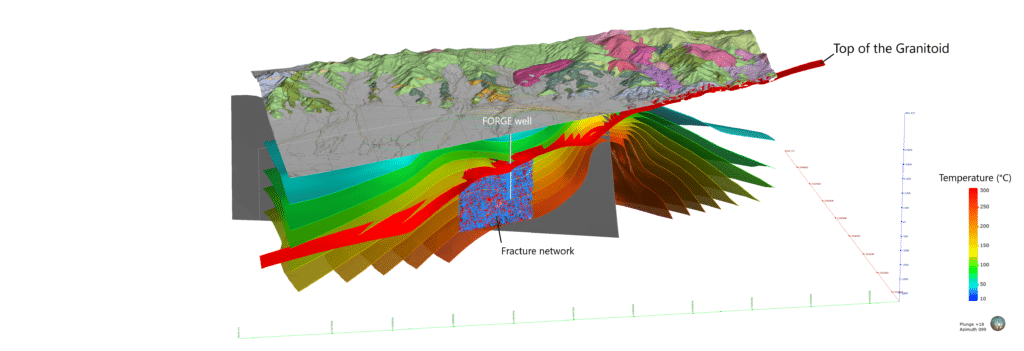
Seequent is half way through a five-year partnership with the Utah FORGE (Frontier Observatory for Research in Geothermal Energy) project at the University of Utah. The project is sponsored by the U.S. Department of Energy (DOE), with the aim to provide research on enhanced geothermal systems (EGS).
The Utah FORGE project team is using Seequent’s solutions to visualise the subsurface at the FORGE site near the town of Milford. The site has been researched since the 1960s, with many wells drilled in the vicinity providing a lot of data in different datasets. This data is reconciled in Leapfrog Energy, Seequent’s 3D modelling solution for the geothermal industry, and Seequent Central is used to manage and visualise the team’s geological data and models centrally.
“An area that we find particularly important is the fact that with Central, we have a web-based server where the entire team can check into it and look at the data sets, they can annotate, they can add comments, so every voice is heard in the decision-making process. As geologists, we are very visual people, we see things, we talk about characteristics, everything’s in a 3D volumetric space. To be able to communicate that, we can all be on the same page, same screen, same volume, and test those things together as a group – I think that’s one of the major impacts that’s been beneficial for us working with Seequent.”
Dr. Robert Podgorney, Modeling and Simulation Lead for the Utah FORGE project

For other Seequent supported projects visit https://www.seequent.com/community/success-stories/


