Article Three is out now — register to get access to the series.
Digital 3D modelling is making enormous waves of change in the field of ground engineering on civil infrastructure. But is 3D modelling always necessary for a project to succeed?
In our previous article, we showed how 3D modelling with cloud-enabled digital solutions aids effective communication between technical and non-technical stakeholders.
In this article, we assess:
- when ground engineering teams should choose 3D modelling
- when 1D or 2D modelling alone is enough
- when a mix of all three can unlock better understanding and problem-solving in geological and geotechnical infrastructure projects
Sharing their insights in this article are:
- Richard Lowries, Senior Customer Solutions Specialist;
- Kathryn Dompierre, GeoStudio Learning and Technical Content Manager at Seequent;
- Sornsawan Utthakrue, Principal Engineering Geologist at Mott MacDonald; and
- Vincent Castonguay, Geotechnical Engineer at AtkinsRéalis.
Why is 3D a game changer for site modelling?
Site modelling has seen a dramatic evolution, from the early hand-drawn 3D conceptual models in the 1950s to the sophisticated 3D digital models of today. This technological transformation has led to more accurate and efficient subsurface modelling, setting a new standard for infrastructure projects.
But despite this progress, adoption of 3D modelling in the civil engineering field isn’t as widespread as it could be.
The current barriers to 3D modelling
Historically, site modelling heavily relied on traditional methods, involving manual interpretation and educated assumptions.
While engineers and geotechnical professionals have long been comfortable with using 2D plans, cross-sections, and paper-based reports to communicate subsurface conditions, today, 2D can often fall short when planning more complex projects.
This leads to inaccuracies around the complexities of subsurface environments — making project planning and execution risky and inefficient.
So why do many professionals continue down this path?
One of the main barriers to adopting digital 3D modelling lies in many geotechnical professionals’ comfort and familiarity with traditional methods, often viewing 3D models as unnecessarily complex or intimidating.
Others hold the misguided belief that 3D modelling is only suited to certain industries like oil and gas or mining, and isn’t applicable to conventional infrastructure projects.
(Many know this definitely isn’t the case — 3D ground models are used across a huge range of infrastructure projects from transportation to urban development.)
Additionally, there’s the perceived complexity of 3D modelling tools and the steep learning curve associated with them. Some engineers have a preference for simplicity, believing the time and effort needed to learn and implement 3D modelling software don’t justify the benefits, especially for smaller or less complex projects.
Data digitisation and management also poses a significant challenge. Past projects stored historical data in non-digital formats, like paper reports, making it difficult to convert useful information into usable 3D models. Integrating large volumes of diverse data sources — like geological surveys, borehole logs, and geotechnical testing results — can also be a daunting task without the right tools and processes in place.

The benefits of 3D modelling
There are plenty of benefits to 3D subsurface modelling that effectively address these outdated misconceptions.
Enhanced visualisation and understanding
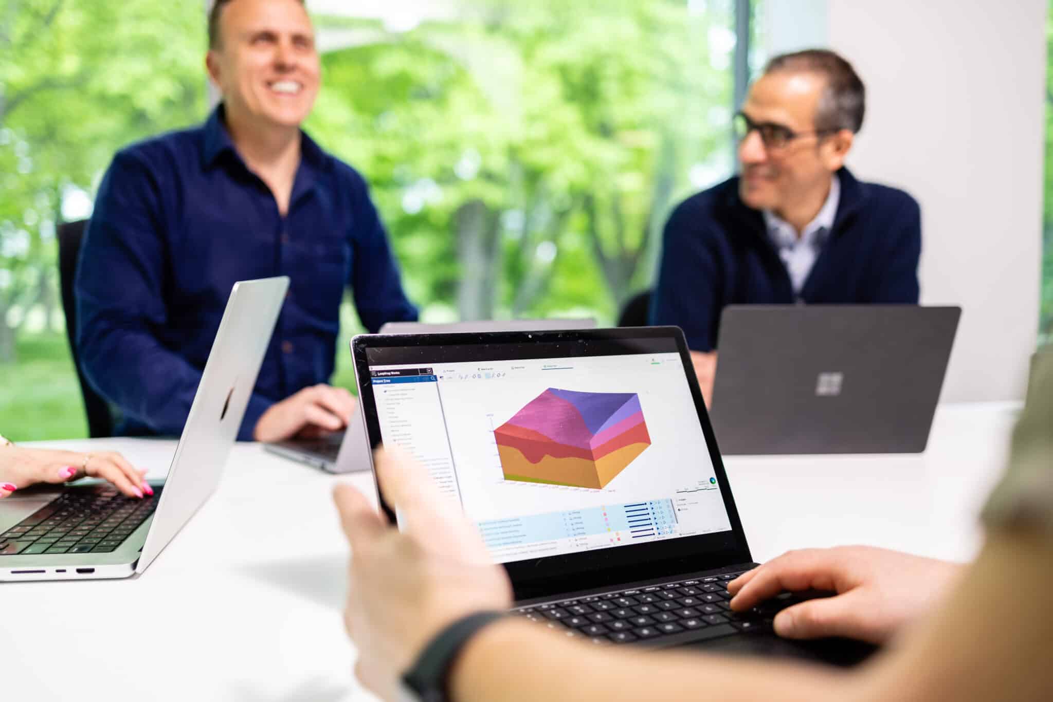
3D models provide a more intuitive and comprehensive view of subsurface conditions compared to 2D drawings, giving civil engineers, engineering geologists, and geotechnical engineers enhanced visualisation of their projects.
Not only does this aid engineers in better understanding the site, but it also improves communication and collaboration between stakeholders. This allows project teams, including non-technical members, to easily grasp the complexities of the project, leading to better-informed decision-making.
"3D geological models are the primary tool for effective communication between various disciplines, as geology is a complex subject that is challenging for other engineers to understand."
Sornsawan UtthakruePrincipal Engineering Geologist, Mott MacDonald
Improved risk assessment and management
By providing detailed, accurate representations of subsurface conditions, 3D models in cloud-enabled platforms like Leapfrog Works allow engineers to spot potential issues earlier in the project lifecycle.
This proactive approach:
- helps mitigate risks
- reduces the likelihood of unexpected problems
- leads to cost and time savings
Engineering teams can also seamlessly integrate 3D models into their design and engineering processes, streamlining workflows and improving their projects’ efficiency.
"3D geological models allow you to integrate the design with the geology model. This lets you highlight any risks associated with the design to the project’s civil or structural engineers, so they can then adjust the design and mitigate the risks."
Richard LowriesSenior Customer Solutions Specialist, Seequent
Better environmental and sustainability decision-making
Understanding subsurface conditions with 3D modelling allows engineers to make more informed decisions that support sustainable practices.
For example, detailed 3D models also help civil engineers:
- identify opportunities for material reuse
- manage contaminants
- reduce the environmental impact of their construction projects
Success story: 3D modelling in action
Today, 3D modelling is applied throughout various types of engineering geology projects — from tunnel construction and digability assessments to landslide management — to visualise complex geological structures.
The Auckland City Rail Link project is a prime example of the real-world value of 3D subsurface modelling in infrastructure development. Using 3D geology models, the project engineers could effectively communicate and understand risks and processes, such as the location of extremely hard basalt lava flows compared to softer infilled materials.
Engineering consultants at Aurecon use our Leapfrog Works tool to not only visualise the data effectively but also to share it with wider technical and non-technical teams in an accessible way.
Applying 3D to your analytical modelling
In infrastructure projects, the choice between 1D, 2D, and 3D modelling plays a key role in making geotechnical assessments more accurate and efficient.
Understanding when and how to integrate 3D analysis significantly enhances project outcomes, particularly when there are clear limitations to using 1D and 2D approaches.
The role of 1D and 2D analysis
Consultants frequently use 1D and 2D analyses because of their relative ease and efficiency.
For many civil infrastructure projects — especially those that are linear in nature, like roads and pipelines — 2D cross-sections often provide enough detail for accurate modelling. This makes 2D analysis a quicker, more practical choice when time and budget constraints limit the scope of data collection.
"Whenever engineers face a complex problem to solve, the best solution most often lies in simplicity."
Vincent CastonguayGeotechnical Engineer, AtkinsRéalis
As a result, consultants are often encouraged to adopt the most simplified modelling approach that meets the project’s needs, avoiding unnecessary complexity that could lead to wasted resources.
So 1D and 2D analyses allow engineers to concentrate on critical aspects of a project without being bogged down by the complexity that a full 3D model would necessitate. This can be particularly effective in geotechnical engineering, where it helps to focus on key factors that impact project success.
For many typical civil projects, 2D analysis captures the essential subsurface conditions and supports effective decision-making.
When 1D and 2D analysis isn’t enough
There are instances, though, when 1D and 2D analyses fall short. Especially when dealing with complex geometries, or conditions that can’t be simplified easily.
"There are problems that simply cannot be simplified to 2D or 1D idealisations because of the 3D nature either of their geometry or of the solicitations imposed. In these instances, 2D just won’t cut it."
Vincent CastonguayGeotechnical Engineer, AtkinsRéalis
For example, tailings storage facilities in mining may feature long, straight sections suitable for 2D modelling. But they could also include corners or areas of extremely varying underlying terrain. In these cases, 2D models can’t capture the full complexity, which can become critical if stability is marginal, or if seepage quantities must be estimated.
Similarly, infrastructure projects involving complex dam structures, open pits, excavations, or dams with high pore-water pressure often demand more nuanced detail — that only 3D analysis can provide.
A full 3D seepage analysis needing to incorporate climatic effects or a stability assessment of a roadway in a mountainous region, for instance, may reveal critical insights that simpler models would miss.
The key? Combining 1D, 2D, and 3D analysis
Effectively combining 1D, 2D, and 3D analysis within the same project allows engineers to harness the strengths of each modelling approach.
"By extruding your linear geometry — like a simple cross-section of a dam — into 3D, you can add 3D elements that represent your dewatering system and capture the 3D impact on your groundwater flow or your pore water pressure values."
Kathryn DompierreGeoStudio Learning and Technical Content Manager, Seequent
Tools like GeoStudio can integrate multiple geometry types into a single project file. This enables engineers to quickly extrude 2D cross-sections into 3D models, helping them assess whether 3D conditions significantly impact overall results.
This approach means engineers can:
- streamline their workflows
- avoid the need to redefine properties when switching between 2D and 3D analysis
- efficiently share data across the project team
For example, running 1D models at various critical points in a 3D domain — like different locations on a hillside or on hill crests — helps provide a focused analysis to capture variations, without needing a full 3D model at every step.
This overall strategy means consultants can start with 1D or 2D models for simplicity and efficiency, and choose to use 3D analysis when specific conditions — like complex material properties — require it.
Success story: 2D and 3D analysis in action
This geotechnical engineering project by SAIDEL Engineering combined 2D analysis with 3D modelling to assess the construction of Bucharest’s first residential building over its subway tunnels.
Using Seequent’s powerful PLAXIS modelling tool, the engineers were able to address complex material conditions that couldn’t be captured fully through 2D analysis alone. Not only did this help the team optimise their modelling process, but it also meant they could meet the project’s requirements without adding unnecessary complexity, saving time and money for the customer.
The future of 3D modelling in geological and geotechnical engineering
With 3D subsurface modelling becoming more commonly accepted across the civil industry, the future of 3D modelling looks promising.
As climate change continues to affect the planet — from global warming to the increasing frequency of extreme weather events — 3D modelling will play a crucial role in sustainability and the optimisation of resources and personnel, helping projects adapt to more complex environmental scenarios.
The key to its continued success, though, lies in combining conceptual and observational modelling techniques, especially as AI and machine learning enter the fray to enhance software capabilities.
But AI and ML are not infallible.
That’s why it’s more important than ever to ensure humans are continuously validating models, and communicating any uncertainties to other stakeholders for effective project planning and management.


