


Coastal communities often face unique challenges over access to fresh water.
As a Universitat de Barcelona study discovered, with the help of a popular geophysical subsurface-imaging technique and Seequent’s software, there are now new, better and non-intrusive ways of exploring and safeguarding the groundwater they rely on.
Surface water resources in coastal regions are scarce, and managing groundwater to ensure a reliable freshwater supply encounters a mosaic of intertwined problems. Seawater intrusion is common and only made worse by urban development, tourism, and agriculture. This intensifies groundwater extraction, leading to further intrusion.. It’s a self-perpetuating problem, and smaller aquifers are particularly vulnerable.
Although water percolation through infiltration ponds is one possible and appealing way to support wastewater reuse, the hydrogeological conditions and the processes involved mean that this requires an intensely detailed understanding of all the intricacies within the system.
So, what did the Spanish town of Port de Selva do to combat it?
Unlocking the possibilities of soil aquifer treatment
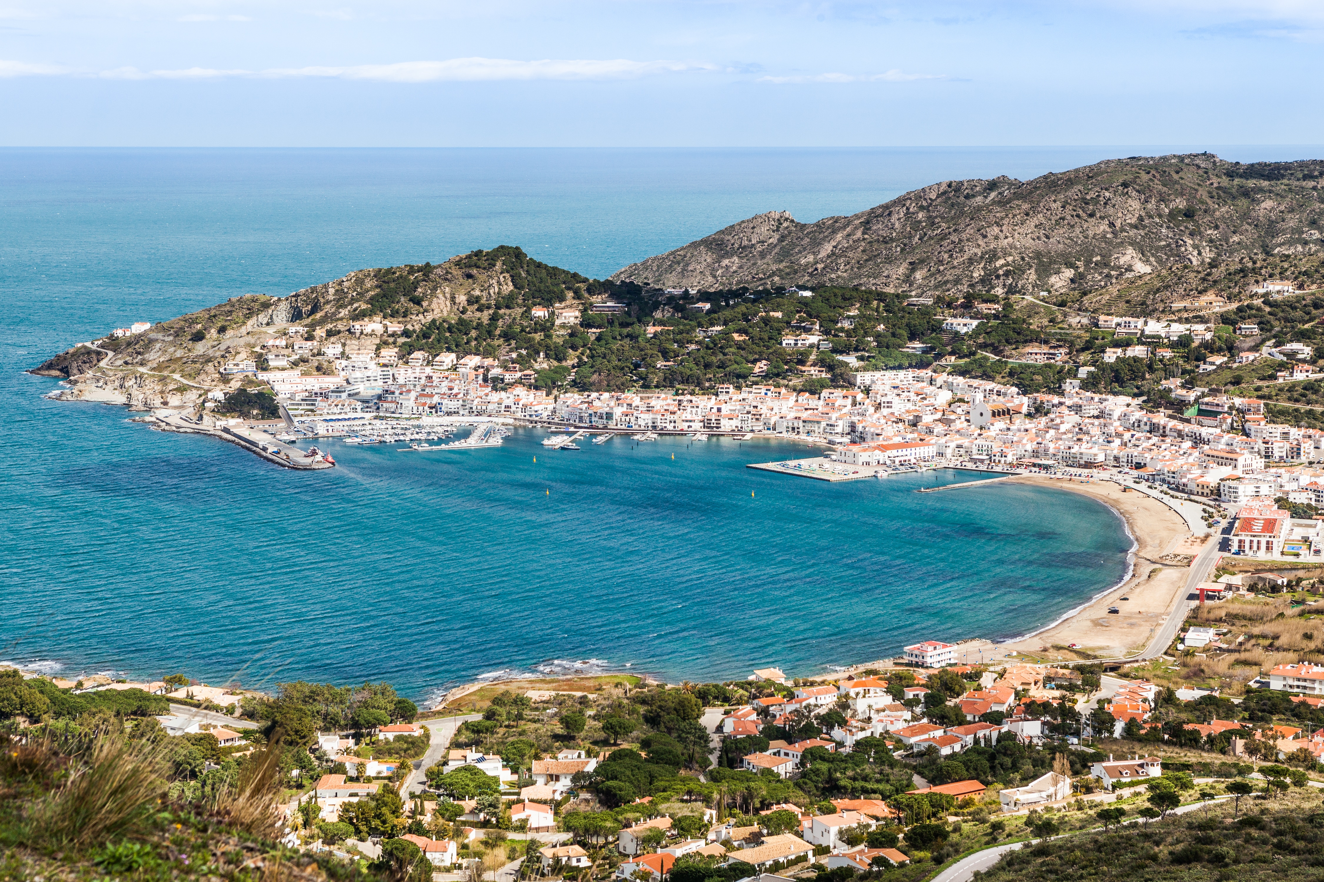
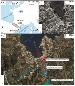
Port de la Selva on the north-eastern coast of the Iberian Peninsula adopted a pioneering approach to the usage of SAT (Soil Aquifer Treatment) to recycle wastewater for recharging aquifers devoted to human consumption – prompted in part by the area’s leap in population from 1,000 in winter to 10,000 in the holiday months.
To help demonstrate the viability of using the natural treatment capacity of the soil and aquifer (without the need for ozonation or reverse osmosis), a thorough understanding of the hydrogeological conditions was required. In a study by the Universitat de Barcelona, the geophysical imaging technique electrical resistivity tomography (ERT) was chosen as a non-invasive technology to provide the detailed subsurface information needed for accurate groundwater modelling.
An interdisciplinary team – scholars, professionals, and students – gathered more than 6300 data points from two electrical resistivity campaigns, and the study turned to a software partnership of Seequent’s Leapfrog Geo and AGS Res2DInv to manipulate and interpret that mass of information.
Speed to insight
”If we didn’t have the ease of integrating geophysical and lithological data from boreholes in Leapfrog Geo software, there’s no way we could have developed the aquifer and saltwater model that fast with a high degree of confidence, says Alex Sendrós
Sendrós’ team relied on AGS Res2DInv to invert the electrical resistivity data, and turn a blurry picture of the underground into a clear one to reduce errors and inform decisions. They adopted Leapfrog Geo to deliver intuitive workflows, rapid data processing, and visualisation tools, and together AGS Res2DInv and Leapfrog Geo were used to forge a comprehensive database of geophysical and lithological information across the site to keep things working fast and efficiently.
Previous modelling studies had only explored aquifer responses to rainfall and pumping. Figuring out where saltwater is mixing with freshwater underground requires complex and time-consuming sampling at different water control points, meaning scientists have to measure different depths and at multiple locations to get a complete picture.
With Leapfrog Geo, this process was made simpler. The record of different rock and soil layers from drilling boreholes, and the raw data associated with it, could be progressively and rapidly incorporated into the 3D aquifer geometry and saltwater intrusion models using implicit modelling tools.
The ERT studies provided crucial insights into the subsurface conditions, revealing issues like high salinity and changes in resistivity due to water extraction, which could hinder the town’s efforts to manage its water resources effectively.
The results facilitated the council’s decision to take effective action. This included using a portable desalination plant at one location, as well as recharging the shallow aquifer with treated water to guarantee the water supply used only local water resources.
Time management, robust procedures, and winning over stakeholders
During the model elaborations procedure, the research team had to efficiently test various scenarios by adjusting key parameters to ensure their model was both accurate and reliable. The less time spent on data input, compilation, and results in visualisation, the more time they had to construct more reliable models using the proposed methodology at other sites and on larger scales.
“It’s all about time management and working with robust procedures, especially in the research field where we’re working with a large amount of data”, explains Sendrós. “We have to deliver top quality results to convince stakeholders and scholars to embrace the approach.”
Take the geophysical data analysis phase, for example. One geologist could turn raw geophysical data into useful geological models, making it more accessible and manageable (step 1) and include it in the Leapfrog workflow (step 2) with ease. With less than one week of training, other team members could follow the two-step procedure using AGS Res2DInv and Leapfrog Geo, too.
The research team will continue their work by using the AGS Res2DInv and Leapfrog Geo workflow to develop sustainable water management procedures while improving stakeholders’ commitment to the boost SAT can bring to water security for coastal communities.