The streamed ERT extension is designed for processing and inversion of continuous towed DC data. Users can import water resistivity and depth as a priori information for the first layer of the model. Its processing capabilities include mean filters and manual processing options, all fully integrated with the GIS interface. Inversion utilises 1D LCI or SCI methodologies, using smooth, sharp, or layered models. Modelling and presentation to the customer are done with the well-known functions of the Workbench, making it easy to integrate with boreholes, create reports, and more.
Key features
-
GIS interface-integrated data processing
-
Import functionality for water resistivity and depth for a priori information
-
1D LCI/SCI inversion with constraints between data points
-
Smooth, sharp, or layered inversion
-
Integrated with the GIS interface
Import
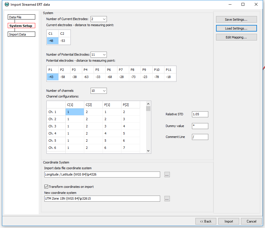
DC data can be imported using a simple column-based spreadsheet format, which also supports additional information for water resistivity and depth for a priori use in inversion. The extension ensures efficient data mapping during import, with the option to save these mappings for future reference.

Processing
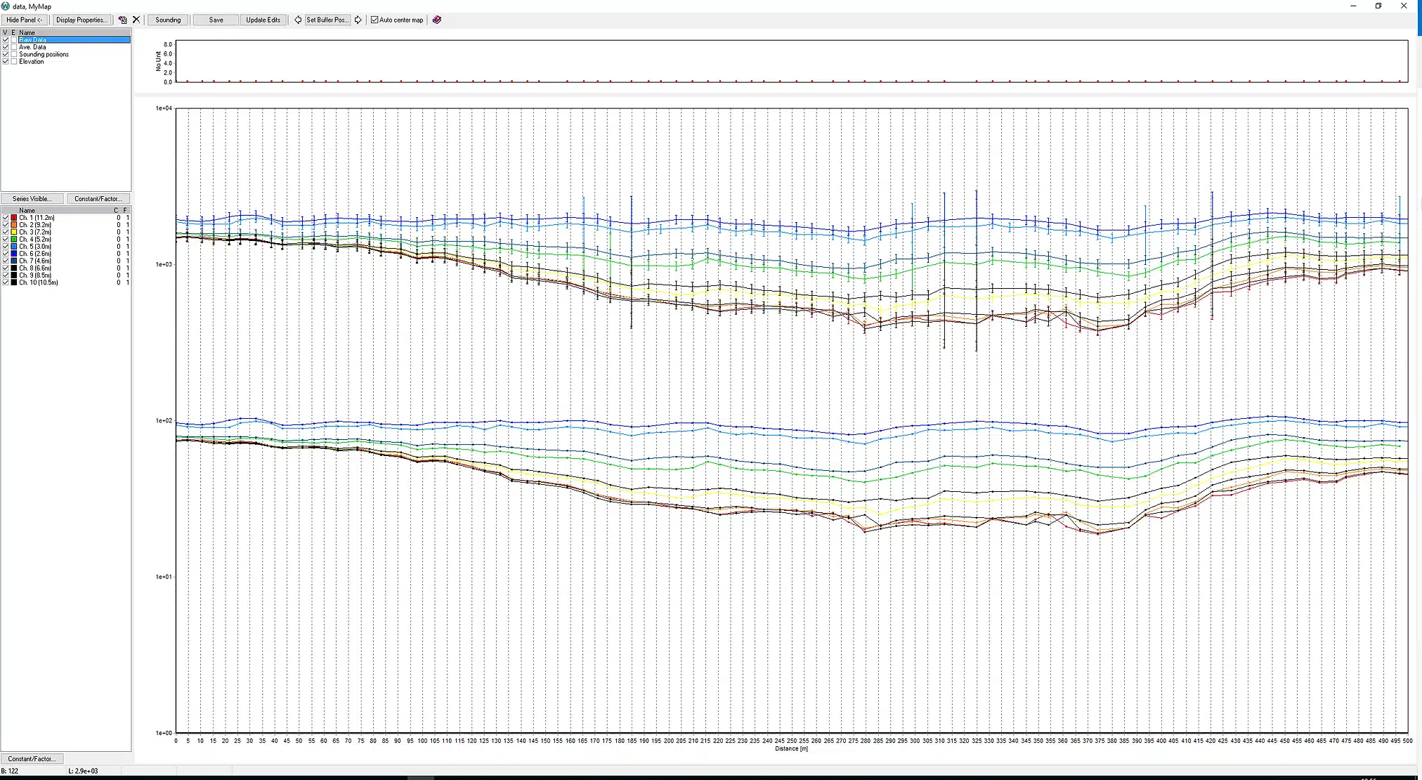
The processing tool, fully integrated with the GIS interface, shows the data points at each focus depth and their corresponding GIS positions. It offers manual processing options, including the ability to disable data points or adjust their standard deviation. Users also have the flexibility to retain raw data for subsequent inversion processes.
Inversion
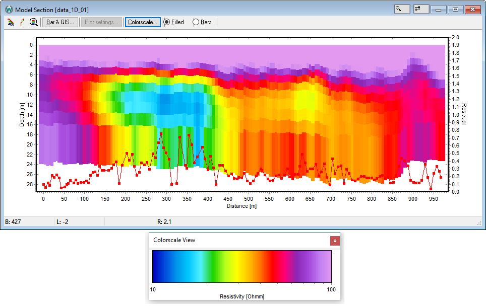
Inversion of the DC data is performed with the AarhusInv code. The data can be inverted as a 1D LCI or SCI with few-layered, many-layered, or sharp models. Starting values for resistivity, thickness, constraints, and chargeability can be individually changed for each layer or optimal values can be chosen automatically. The extension’s design supports multi-CPU core use, ensuring high parallel efficiency in data processing and inversion tasks.


