


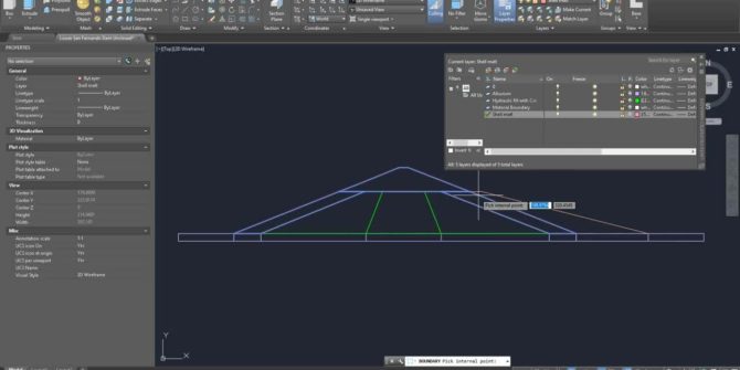
Importing Regions from AutoCAD
This video reviews the methods for importing regions from DXF/DWG files, common issues experienced when importing regions, and AutoCAD tips for resolving these issues. JTNDJTIxLS0lMjBUaGUlMjBzY3JpcHQlMjB0YWclMjBzaG91bGQlMjBsaXZlJTIwaW4lMjB0aGUlMjBoZWFkJTIwb2YlMjB5b3VyJTIwcGFnZSUyMGlmJTIwYXQlMjBhbGwlMjBwb3NzaWJsZSUyMC0tJTNFJTBBJTNDc2NyaXB0JTIwdHlwZSUzRCUyMnRleHQlMkZqYXZhc2NyaXB0JTIyJTIwYXN5bmMlMjBzcmMlM0QlMjJodHRwcyUzQSUyRiUyRnBsYXkudmlkeWFyZC5jb20lMkZlbWJlZCUyRnY0LmpzJTIyJTNFJTNDJTJGc2NyaXB0JTNFJTBBJTBBJTNDJTIxLS0lMjBQdXQlMjB0aGlzJTIwd2hlcmV2ZXIlMjB5b3UlMjB3b3VsZCUyMGxpa2UlMjB5b3VyJTIwcGxheWVyJTIwdG8lMjBhcHBlYXIlMjAtLSUzRSUwQSUzQ2ltZyUwQSUyMCUyMHN0eWxlJTNEJTIyd2lkdGglM0ElMjAxMDAlMjUlM0IlMjBtYXJnaW4lM0ElMjBhdXRvJTNCJTIwZGlzcGxheSUzQSUyMGJsb2NrJTNCJTIyJTBBJTIwJTIwY2xhc3MlM0QlMjJ2aWR5YXJkLXBsYXllci1lbWJlZCUyMiUwQSUyMCUyMHNyYyUzRCUyMmh0dHBzJTNBJTJGJTJGcGxheS52aWR5YXJkLmNvbSUyRnR1MkxiZzRqdkJTODRyMjZnTHlBZksuanBnJTIyJTBBJTIwJTIwZGF0YS11dWlkJTNEJTIydHUyTGJnNGp2QlM4NHIyNmdMeUFmSyUyMiUwQSUyMCUyMGRhdGEtdiUzRCUyMjQlMjIlMEElMjAlMjBkYXRhLXR5cGUlM0QlMjJpbmxpbmUlMjIlMEElMkYlM0UlMEE=
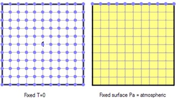
Verification – Heated Closed System
The objective of this example is to verify the simulated change in pressure of a constant volume of dry air subject to an increase in
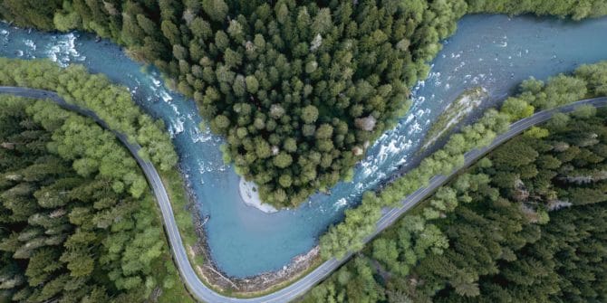
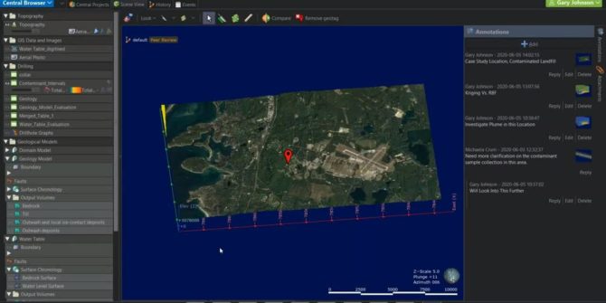
A clear view of the problem is never more important than in a contamination incident
Specialists solutions for those working in the environmental industry need to address everything from collaboration to clear communication to the day in court when every decision is
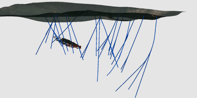
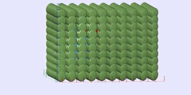
Importing Wedge Holes in Leapfrog Geo
Leapfrog contains helpful tools that can identify errors and warnings in its drillhole database. These tools can identify things such as invalid values, missing values
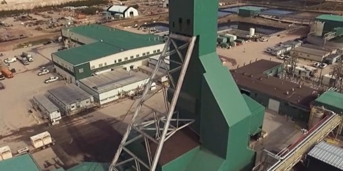
Cameco Corporation enables data-driven discovery
Cameco Corporation, one of the world's largest Uranium mining companies, delivers data-driven and knowledge-driven discovery by using Seequent Central. Learn how Seequent Central can help
Introducing Structural Trends in Leapfrog Geo
Duration 6 min JTNDJTIxLS0lMjBUaGUlMjBzY3JpcHQlMjB0YWclMjBzaG91bGQlMjBsaXZlJTIwaW4lMjB0aGUlMjBoZWFkJTIwb2YlMjB5b3VyJTIwcGFnZSUyMGlmJTIwYXQlMjBhbGwlMjBwb3NzaWJsZSUyMC0tJTNFJTBBJTNDc2NyaXB0JTIwdHlwZSUzRCUyMnRleHQlMkZqYXZhc2NyaXB0JTIyJTIwYXN5bmMlMjBzcmMlM0QlMjJodHRwcyUzQSUyRiUyRnBsYXkudmlkeWFyZC5jb20lMkZlbWJlZCUyRnY0LmpzJTIyJTNFJTNDJTJGc2NyaXB0JTNFJTBBJTBBJTNDJTIxLS0lMjBQdXQlMjB0aGlzJTIwd2hlcmV2ZXIlMjB5b3UlMjB3b3VsZCUyMGxpa2UlMjB5b3VyJTIwcGxheWVyJTIwdG8lMjBhcHBlYXIlMjAtLSUzRSUwQSUzQ2ltZyUwQSUyMCUyMHN0eWxlJTNEJTIyd2lkdGglM0ElMjAxMDAlMjUlM0IlMjBtYXJnaW4lM0ElMjBhdXRvJTNCJTIwZGlzcGxheSUzQSUyMGJsb2NrJTNCJTIyJTBBJTIwJTIwY2xhc3MlM0QlMjJ2aWR5YXJkLXBsYXllci1lbWJlZCUyMiUwQSUyMCUyMHNyYyUzRCUyMmh0dHBzJTNBJTJGJTJGcGxheS52aWR5YXJkLmNvbSUyRjJwRnFCeDFoOWEzM05HcG5pV3lRNFEuanBnJTIyJTBBJTIwJTIwZGF0YS11dWlkJTNEJTIyMnBGcUJ4MWg5YTMzTkdwbmlXeVE0USUyMiUwQSUyMCUyMGRhdGEtdiUzRCUyMjQlMjIlMEElMjAlMjBkYXRhLXR5cGUlM0QlMjJpbmxpbmUlMjIlMEElMkYlM0UlMEE= Video Transcript [00:00:02.540] <v Instructor>Welcome to this quick tutorial</v> [00:00:04.450] on getting started with structural trends. [00:00:06.740] This follows on from
Get to the Point Faster – Upgraded Points Database
In the latest release of Leapfrog Geo v 5.1.0 important changes have been made to the imported points object. While on the surface you may
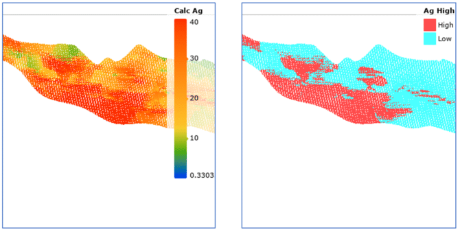
Introducing Seequent’s Contaminants extension
The extension is an intuitive and easy to learn solution to help you characterise land and groundwater contaminant plumes right inside your Leapfrog project. In