


How Talisker Resources streamlined data collection to prospect lightning-fast
This junior exploration company holds the largest land package staked in a single day in British Columbia (BC) history. The massive landscape scattered their team
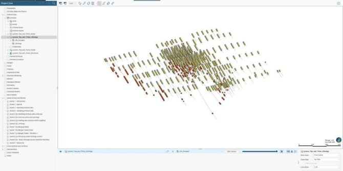
How Mercator Geological Services works all over the world, from their desktops
When COVID-19 hit, many companies were scrambling. They had to change their workflows. VPNs were introduced, new software products were trialed, home offices were set
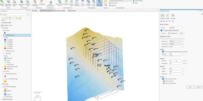
Technical Tuesday: Drillhole Data Tips for Leapfrog
Zoe will present workflows and go over precautions to consider when setting up your drillhole database in Leapfrog before you commence modelling. Drillhole interval data
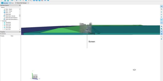
Groundwater Pumping and Drawdown Maps in SEEP3D
The ultimate goal of a dewatering analysis is to understand the transient response of the flow system and determine pumping rates, pore-water pressure distribution, and
Enhanced modelling and collaboration with Central
Overview SpeakersPeter Joynt Product Manager for Central - SeequentDuration15 minJTNDJTIxLS0lMjBUaGUlMjBzY3JpcHQlMjB0YWclMjBzaG91bGQlMjBsaXZlJTIwaW4lMjB0aGUlMjBoZWFkJTIwb2YlMjB5b3VyJTIwcGFnZSUyMGlmJTIwYXQlMjBhbGwlMjBwb3NzaWJsZSUyMC0tJTNFJTNDc2NyaXB0JTIwdHlwZSUzRCUyMnRleHQlMkZqYXZhc2NyaXB0JTIyJTIwYXN5bmMlMjBzcmMlM0QlMjJodHRwcyUzQSUyRiUyRnBsYXkudmlkeWFyZC5jb20lMkZlbWJlZCUyRnY0LmpzJTIyJTNFJTNDJTJGc2NyaXB0JTNFJTNDJTIxLS0lMjBQdXQlMjB0aGlzJTIwd2hlcmV2ZXIlMjB5b3UlMjB3b3VsZCUyMGxpa2UlMjB5b3VyJTIwcGxheWVyJTIwdG8lMjBhcHBlYXIlMjAtLSUzRSUzQ2ltZyUyMCUyMHN0eWxlJTNEJTIyd2lkdGglM0ElMjAxMDAlMjUlM0IlMjBtYXJnaW4lM0ElMjBhdXRvJTNCJTIwZGlzcGxheSUzQSUyMGJsb2NrJTNCJTIyJTIwJTIwY2xhc3MlM0QlMjJ2aWR5YXJkLXBsYXllci1lbWJlZCUyMiUyMCUyMHNyYyUzRCUyMmh0dHBzJTNBJTJGJTJGcGxheS52aWR5YXJkLmNvbSUyRkd1bk1wUEpjc3gyWUp2UnJHU2dZU2QuanBnJTIyJTIwJTIwZGF0YS11dWlkJTNEJTIyR3VuTXBQSmNzeDJZSnZSckdTZ1lTZCUyMiUyMCUyMGRhdGEtdiUzRCUyMjQlMjIlMjAlMjBkYXRhLXR5cGUlM0QlMjJpbmxpbmUlMjIlMkYlM0UlMEE= Video Transcript [00:00:00.474] (calming music) [00:00:10.360] <v Peter>Hello, everyone.</v> [00:00:12.420] Welcome, my name's Peter. [00:00:14.010]
Target for ArcGIS Pro: importing and visualizing your geoscience data using MX Deposit
We will show you how to import and refresh from MX Deposit. Integrate your exploration data in 2D and 3D. Come check out what’s included
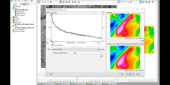
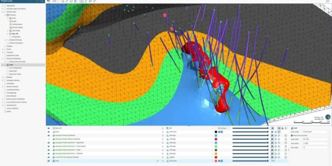
Technical Tuesday: Integrating Geophysics into your 3D Model
With Seequent applications and cloud collaboration, geophysical data can be utilised effectively to improve your geological model. Interactive 2D filtering and VOXI modelling results can
Getting started with Target
Welcome to Target, to start, you need to complete a few simple steps. Create your Seequent ID Your Seequent ID is your business email address