


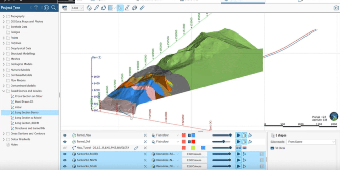
What’s new in Leapfrog Works 2021.1
Leapfrog Works 2021.1 sees major enhancements to the Leapfrog engine – building upon previous releases to deliver powerful new features and functionality. Ready to discover
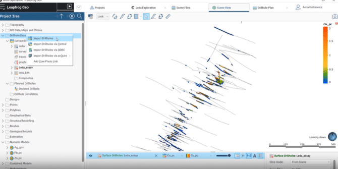
What’s new in Leapfrog Geo and Edge 2021.1
Leapfrog Geo and Edge 2021.1 sees major enhancements to the Leapfrog engine – building upon previous releases to deliver powerful new features and functionality. Ready

How a Nordic highway reduced drilling by 30% with AEM, Workbench, and machine learning
They estimated it would require around 600 boreholes for the project, and EMerald Geomodelling reduced that by 30%. That's around 200 less boreholes to do
5 ways mining projects use resistivity models to reduce risks
Mining is high risk at every stage: you must find the minerals, safely and efficiently extract them, and ensure minimal environmental impact. Mining and exploration
Bentley Systems Announces Seequent’s Acquisition of Aarhus GeoSoftware
Enriching Subsurface Digital Twins through Electromagnetic Remote Sensing for Water, Environmental, and Infrastructure Resilience. EXTON, Pa. – July 7, 2021 – Bentley Systems, Incorporated (Nasdaq:
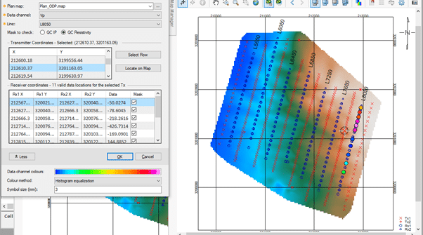
Validate your IP & Resistivity data more effectively in Oasis montaj 9.10
In the IP & Resistivity extension of Oasis montaj, you can now find more tools for enhancing visualisation of electrical data from IP surveys. Discover
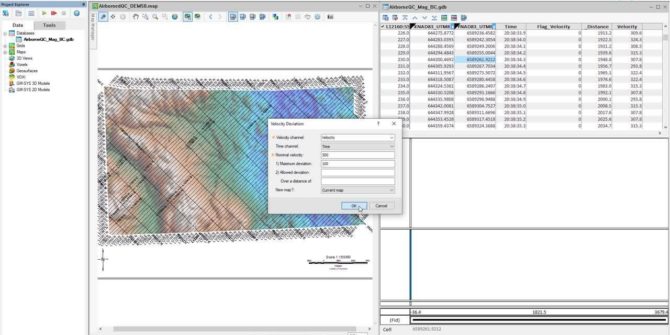
Increased confidence in your Airborne Data with Oasis montaj 9.10
The Airborne Quality Control extension for Oasis montaj allows you to design and plan airborne Geophysical surveys. In addition, you may perform industry-standard quality control
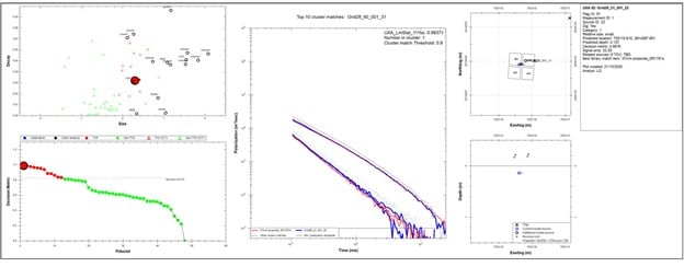
New UX-Analyze menus for a more intuitive workflow
Our Advanced Geophysical Classification (AGC) workflow for unexploded ordnance (UXO) and explosive remnants of war (ERW), known as UX-Analyze, has been used by industry professional