


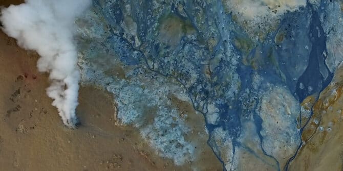
How one university uses Oasis montaj to find geothermal energy for Africa
Calistus Ramotoroko explores geothermal potential deep beneath the Kasane hot springs in Botswana, Africa. Geothermal exploration is on the rise in Africa as the continent
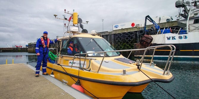
How SEP Hydrographic uses Oasis montaj to protect offshore wind farms from UXO threats
Offshore UXO can be an unpleasant surprise and a major headache for UK wind farm construction. SEP Hydrographic have been using Oasis montaj and UXO
Better in ten – Oasis montaj
From the autosave reminder and viewing multiple profiles, to how to compare two grids with very different profiles, whether you are new to Oasis montaj
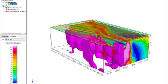
Create more advanced manipulations with generic surface (mesh) utilities in Oasis montaj and Target 2021.2
Oasis montaj and Target 2021.2 now provide customers with more ways to work with generic surface (mesh) utilities. You now can create more advanced manipulations
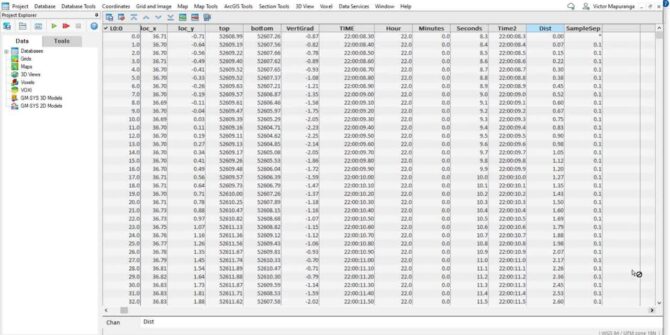
Using the Channel Math Tool to QC geophysical datasets in Oasis Montaj
In this video we show how the user can use the Channel Math tool to calculate sample separation, velocity and heading for the purposes of
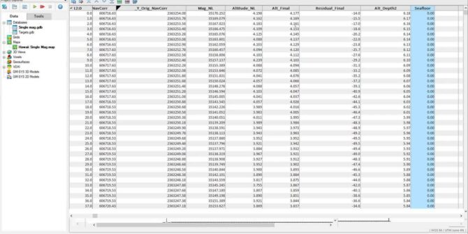
Survey Coverage tool in the UXO marine extension
Using the sensor footprint at the seafloor, and the sensor altitude, easily determine what percent of the survey area has been surveyed and visualise this
How to update a video card driver
Objective: I would like to update my video card driver to the most recent release version possible. Resolution: Windows 7 & 10 From the Control Panel select Device
How to configure Leapfrog to connect to a Proxy
Objective: I want to configure Leapfrog to work with my network's proxy. Resolution: To configure Leapfrog, you can access the relevant settings by selecting the