


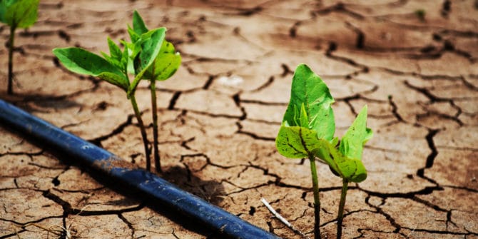
Geophysical techniques identify fresh water for refugees
Geophysicist Paul Bauman was teaching a short course on finding groundwater sources at the UN’s Kakuma refugee camp in Kenya when he realized his skills could be
Aeromagnetic data helps to assess earthquake potential
As any earth scientist knows, earthquakes are notoriously difficult to predict. It’s clear to most other people too—we’ve all witnessed the devastating effects of earthquakes
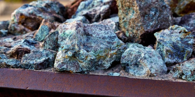
MVI excels at identifying copper porphyry-related intrusives
To verify the potential for Magnetization Vector Inversion (MVI) to identify deep intrusives related to copper porphyry systems, veteran copper explorer Carl Windels has compiled several North
Gamma ray spectrometry proves it worth as a mapping tool in granite-rich terrain
In areas with limited accessibility and/or a scarcity of outcrop, airborne geophysical techniques can sometimes be used to map geology. Gamma-ray spectrometry, for instance, works

3D modelling helps district in Nebraska get a better handle on water quality
A district in Nebraska is using 3D models generated from airborne electromagnetic (AEM) survey results and borehole data to manage land use in an area

From Data to Discovery – an Integrated Approach to Exploration
Overview Speakers Sara Lise Underhay Technical Analysis - Geosoft Europe Carlo Combrinck Technical Analysis - Geosoft Africa Duration 22 min JTNDJTIxLS0lMjBUaGUlMjBzY3JpcHQlMjB0YWclMjBzaG91bGQlMjBsaXZlJTIwaW4lMjB0aGUlMjBoZWFkJTIwb2YlMjB5b3VyJTIwcGFnZSUyMGlmJTIwYXQlMjBhbGwlMjBwb3NzaWJsZSUyMC0tJTNFJTBBJTNDc2NyaXB0JTIwdHlwZSUzRCUyMnRleHQlMkZqYXZhc2NyaXB0JTIyJTIwYXN5bmMlMjBzcmMlM0QlMjJodHRwcyUzQSUyRiUyRnBsYXkudmlkeWFyZC5jb20lMkZlbWJlZCUyRnY0LmpzJTIyJTNFJTNDJTJGc2NyaXB0JTNFJTBBJTBBJTNDJTIxLS0lMjBQdXQlMjB0aGlzJTIwd2hlcmV2ZXIlMjB5b3UlMjB3b3VsZCUyMGxpa2UlMjB5b3VyJTIwcGxheWVyJTIwdG8lMjBhcHBlYXIlMjAtLSUzRSUwQSUzQ2ltZyUwQSUyMCUyMHN0eWxlJTNEJTIyd2lkdGglM0ElMjAxMDAlMjUlM0IlMjBtYXJnaW4lM0ElMjBhdXRvJTNCJTIwZGlzcGxheSUzQSUyMGJsb2NrJTNCJTIyJTBBJTIwJTIwY2xhc3MlM0QlMjJ2aWR5YXJkLXBsYXllci1lbWJlZCUyMiUwQSUyMCUyMHNyYyUzRCUyMmh0dHBzJTNBJTJGJTJGcGxheS52aWR5YXJkLmNvbSUyRkZRekRIOTJTak44NGtuOWFoa0UzUksuanBnJTIyJTBBJTIwJTIwZGF0YS11dWlkJTNEJTIyRlF6REg5MlNqTjg0a245YWhrRTNSSyUyMiUwQSUyMCUyMGRhdGEtdiUzRCUyMjQlMjIlMEElMjAlMjBkYXRhLXR5cGUlM0QlMjJpbmxpbmUlMjIlMEElMkYlM0UlMEElMEE= Video Transcript The video
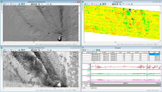
N-Sea clears the way for windfarms
Netherlands-based N-Sea has selected Geosoft’s Oasis montaj and UXO Marine software to detect unexploded ordinance that pose a hazard to its customers operating in the North Sea and other offshore regions.

Effective approaches to potential field modelling in hydrocarbon exploration
In a challenging economic environment, potential field modelling can prove extremely useful to hydrocarbons exploration. Potential field interpretation has benefited from recent technological advances, often