


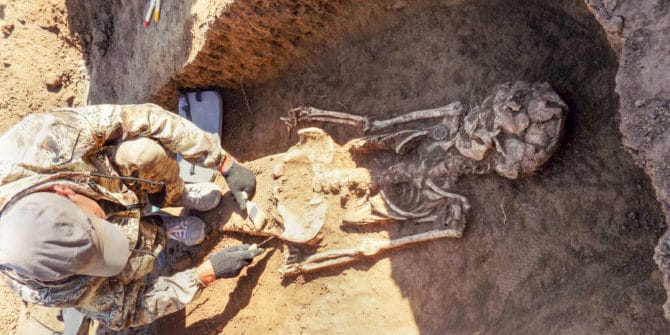
How Geoscience Helps Archaeologists Understand History
Archaeologists are experts at reading the earth as they uncover lost historical treasures, collecting information about how we lived and understanding the past. Now, archaeologists
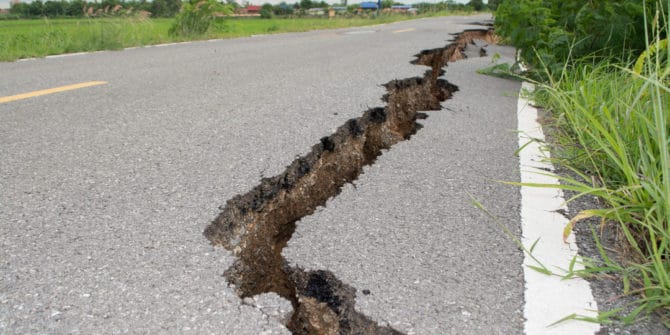
Finding Faults: Improving Human Safety in Earthquake-Prone Areas
Humans have coexisted with potential geological and other natural disasters since the dawn of time. Volcanic eruptions, earthquakes, typhoons, and hurricanes have contributed to significant
Life on board a UXO survey
Nigel Halsall, Solutions Consultant, trained and supported personnel from subsea services provider N-Sea. So when the manager there asked if he’d be interested in spending
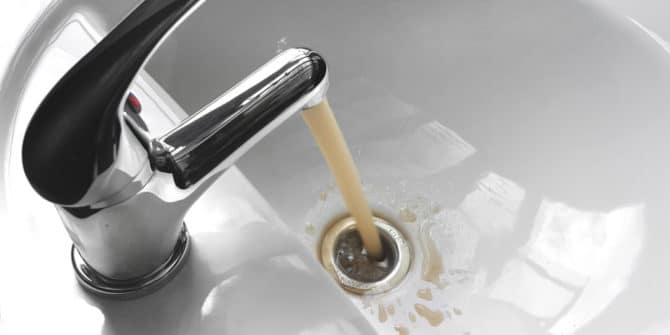
What’s Lurking in Your Tap Water? Near Surface Geoscience Can Uncover Invisible Dangers
Tap water is supposed to be clean. After all, your municipal water specialists manage it to keep you and your family safe. It usually looks
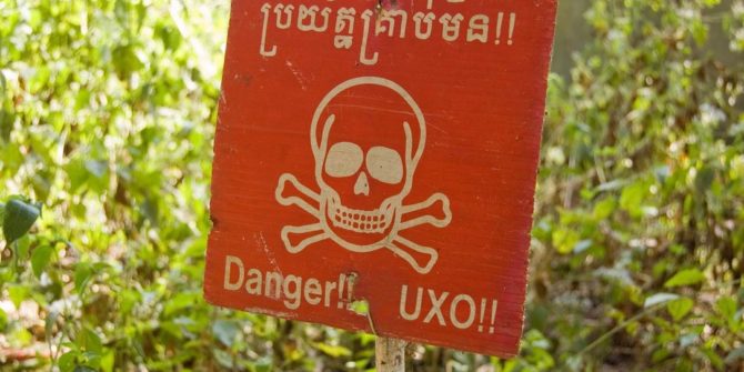
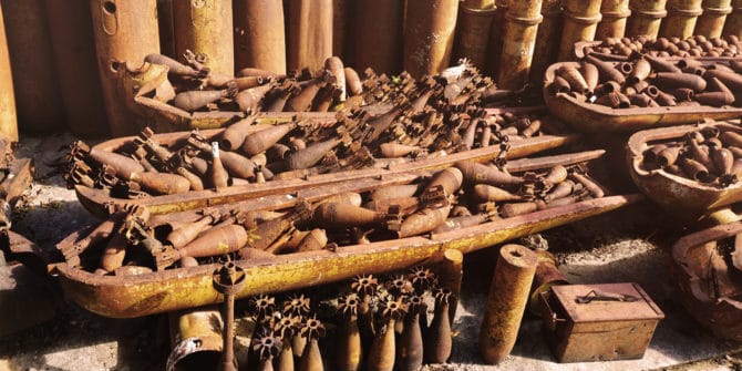
Protecting Populations Through Unexploded Ordnance (UXO) Detection
Unexploded ordnance (UXO) represents a distinguished threat in many war-torn countries. Despite progress at the turn of the century, including promises to discontinue anti-personnel mines
New value from old data shows promise for geothermal exploration in the Netherlands
Making the transition from fossil fuels to renewable energy, the Netherlands is promoting development of geothermal sources. Dutch consumers currently depend heavily on natural gas
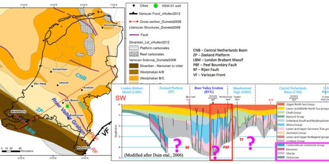
New value from old data shows promise for geothermal exploration in the Netherlands
Making the transition from fossil fuels to renewable energy, the Netherlands is promoting development of geothermal sources. Dutch consumers currently depend heavily on natural gas
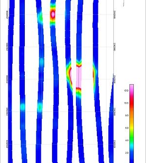
Using magnetic gradient arrays for marine UXO surveys
Collecting and using magnetic gradient data for locating ferrous targets such as unexploded ordnance (UXO) or explosive remnants of war (ERW) in marine environments can