


UAV Survey
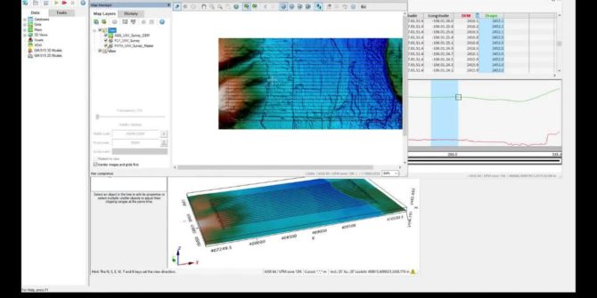
How to plan an unmanned aerial vehicle (UAV) magentic survey Define survey Defining sub-areas Creating a drape elevation Visual line of sight test (VLOS) Duration15
UXO Land Quality Control
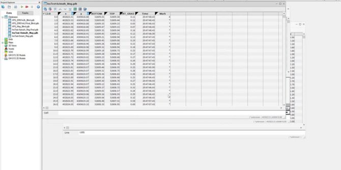
UXO Land QC Heading corrections Sample separation Velocity Footprint coverage Heading corrections Instrument tests: Azimuth test: operator rotates around a magnetic sensor Octant test: operator
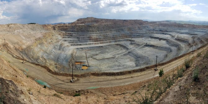
Erdenet Mining Corp’s digital revolution with Seequent
On the outskirts of Mongolia’s second largest city, Erdenet Mining Corp holds one of the largest porphyry-copper deposits in the country. To sustainably mine a
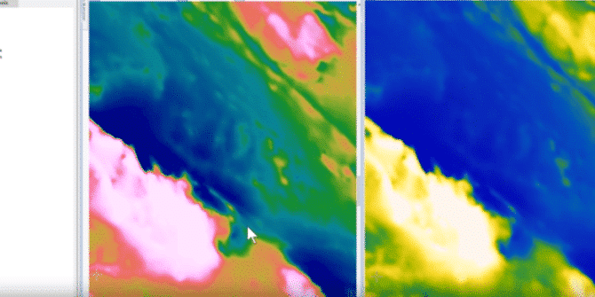
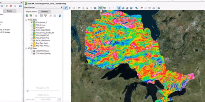
How to elevate your magnetic data in Oasis montaj
Using open-source Geoscience data, we will illustrate how Oasis montaj can improve your understanding of magnetic data. This webinar will highlight some of the magnetic
Geophysics for Geologists
Learn about how you can utilize geophysics to add value to your exploration project. Find out how it is possible to use geophysics to generate
Exploration and targeting of gold mineralisation in Burkina Faso using Airborne Geophysics
This presentation was recorded at PDAC 2020. Overview Speakers Jean Legault Chief Geophysicist - Geotech Ltd Duration 14 min JTNDJTIxLS0lMjBUaGUlMjBzY3JpcHQlMjB0YWclMjBzaG91bGQlMjBsaXZlJTIwaW4lMjB0aGUlMjBoZWFkJTIwb2YlMjB5b3VyJTIwcGFnZSUyMGlmJTIwYXQlMjBhbGwlMjBwb3NzaWJsZSUyMC0tJTNFJTBBJTNDc2NyaXB0JTIwdHlwZSUzRCUyMnRleHQlMkZqYXZhc2NyaXB0JTIyJTIwYXN5bmMlMjBzcmMlM0QlMjJodHRwcyUzQSUyRiUyRnBsYXkudmlkeWFyZC5jb20lMkZlbWJlZCUyRnY0LmpzJTIyJTNFJTNDJTJGc2NyaXB0JTNFJTBBJTBBJTNDJTIxLS0lMjBQdXQlMjB0aGlzJTIwd2hlcmV2ZXIlMjB5b3UlMjB3b3VsZCUyMGxpa2UlMjB5b3VyJTIwcGxheWVyJTIwdG8lMjBhcHBlYXIlMjAtLSUzRSUwQSUzQ2ltZyUwQSUyMCUyMHN0eWxlJTNEJTIyd2lkdGglM0ElMjAxMDAlMjUlM0IlMjBtYXJnaW4lM0ElMjBhdXRvJTNCJTIwZGlzcGxheSUzQSUyMGJsb2NrJTNCJTIyJTBBJTIwJTIwY2xhc3MlM0QlMjJ2aWR5YXJkLXBsYXllci1lbWJlZCUyMiUwQSUyMCUyMHNyYyUzRCUyMmh0dHBzJTNBJTJGJTJGcGxheS52aWR5YXJkLmNvbSUyRlR3OVRnUTUxNVBWdlNYMUhnS2ViRjIuanBnJTIyJTBBJTIwJTIwZGF0YS11dWlkJTNEJTIyVHc5VGdRNTE1UFZ2U1gxSGdLZWJGMiUyMiUwQSUyMCUyMGRhdGEtdiUzRCUyMjQlMjIlMEElMjAlMjBkYXRhLXR5cGUlM0QlMjJpbmxpbmUlMjIlMEElMkYlM0UlMEE= Video Transcript [00:00:00.811] (gentle music)
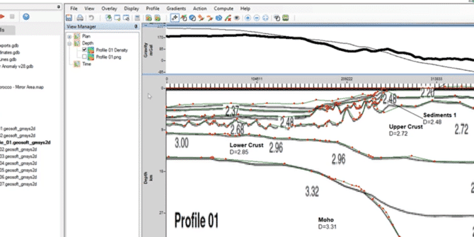
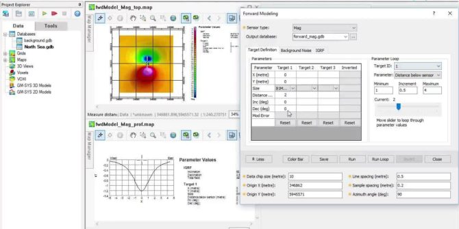
Oasis montaj: Building and Managing 2D Models in GM-SYS
The GM-SYS extensions are trusted by international government surveys and the exploration programs of the world’s most successful energy companies. The webinar covers:• Methods for building