


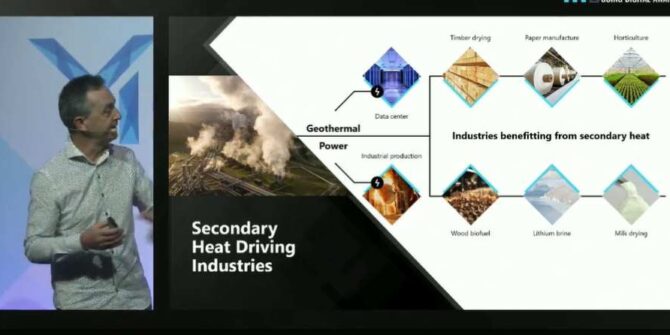

Bentley Systems Announces Seequent’s Acquisition of Geothermal Simulation Leader Flow State Solutions
PRESS RELEASE: Combines Seequent’s Geological Modeling with Flow State Solutions’ Geothermal Simulation Software SINGAPORE – Oct. 11, 2023 – Bentley Systems, Incorporated (Nasdaq: BSY), the

Meet the mines of the future: advanced robotics, autonomous vehicles, and AI-driven digital twins
Discover how technological advancements like digital twins and AI are transforming the mining industry. Learn about the latest innovations that are improving efficiency, safety, and

Civil infrastructure geoprofessionals are ready to adopt the cloud, new report says
NEWS ALERT: Report highlights time-consuming data management practices, with data residing in disparate ‘silos’ CHRISTCHURCH, NEW ZEALAND, July 19, 2023 – Seequent, The Bentley Subsurface

Mining industry sees data as vital but still struggles to make data-driven decisions
NEWS ALERT: New global research reveals that nearly two in three geoprofessionals are using or considering emerging technologies such as artificial intelligence and machine learning