


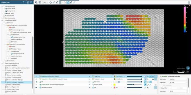
Contamination Extension for Leapfrog Works: Demonstration and Live Q&A
The webinar will cover: An introduction to the Contaminants Extension for Leapfrog Works. The Contaminants Extension Workflow – with a brief overview of: Data Preparation
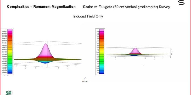
Magnetic Surveying for anthropogenic objects: The theory
The theory, data acquisition and data processing. The webinars are jointly delivered by Seequent and Geometrics. Search for man-made objects in the near surface has
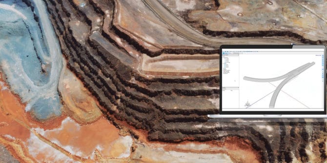
Importing to BUILD3D: Import from CAD Sources
This tutorial uses GeoStudio 2021.3 and will show you how to import 3D CAD files in the *.step, *.iges, *.dxf, *.dwg, and *.stl file formats.
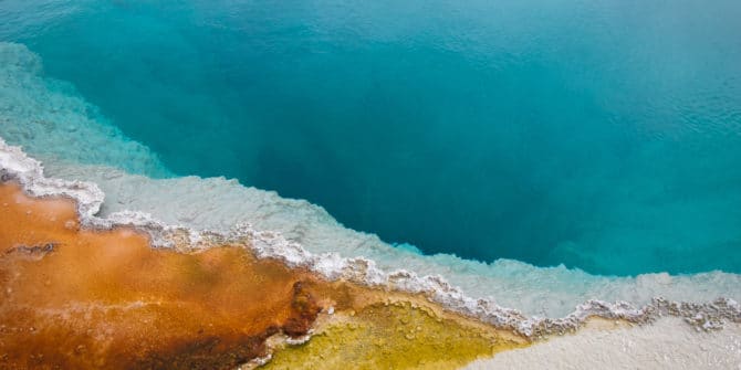
Welcoming a new era in Geothermal at WGC 2020+1
It is great to see that this week in Iceland over 1000 people are expected to be able to connect in-person at the World Geothermal
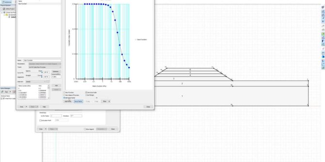
GeoStudio Core: Integrating SLOPE/W, SEEP/W, and SIGMA/W to solve more complex problems
This video will take you through the step-by-step process of defining the analysis tree, materials, and geometry, followed by reviewing the results of an example
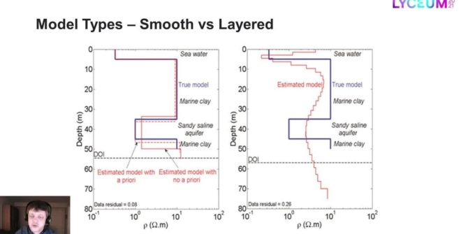
Model types for the inversion of TEM/FEM data in Aarhus Workbench
Most inversions are done with smooth models only, but often the resolution is good enough to sense more abrupt changes in the geology than the
Industrial Minerals: Moving the ESG needle in mining – from threat to opportunity
Our roundtable of leading industry thinkers examines some of the key trends and initiatives that are pulling industrial minerals mining towards a more sustainable future,
Capture, Catalogue, Connect and Learn: Maximising value from geological imagery – Imago Roundtable
Lyceum 2021 | Together Towards TomorrowThe topics covered will include the application of machine learning to extract value from geoscientific imagery and other relevant practices.