


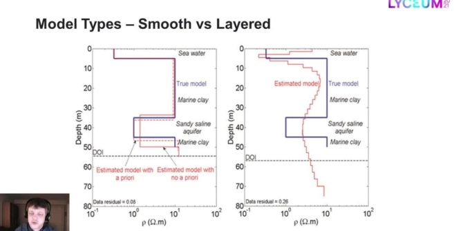
Model types for the inversion of TEM/FEM data in Aarhus Workbench
Most inversions are done with smooth models only, but often the resolution is good enough to sense more abrupt changes in the geology than the
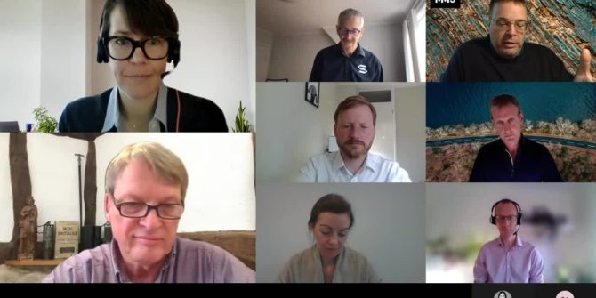
Industrial Minerals: Moving the ESG needle in mining – from threat to opportunity
Our roundtable of leading industry thinkers examines some of the key trends and initiatives that are pulling industrial minerals mining towards a more sustainable future,
Capture, Catalogue, Connect and Learn: Maximising value from geological imagery – Imago Roundtable
Lyceum 2021 | Together Towards TomorrowThe topics covered will include the application of machine learning to extract value from geoscientific imagery and other relevant practices.
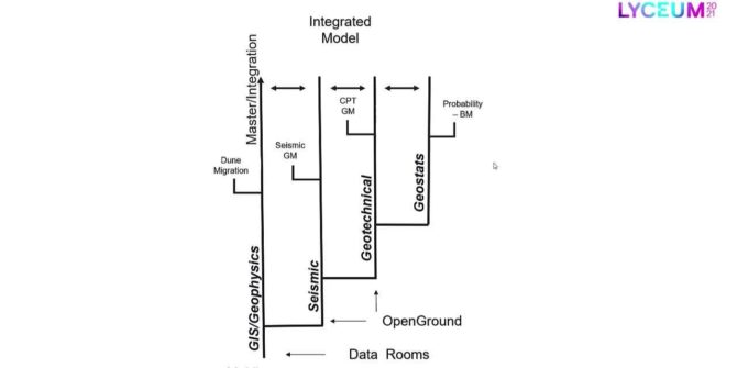
A central case study: Multi-disciplinary approach to managing big data for offshore windfarm development
This presentation explores strategic approaches for overcoming common challenges associated with modelling large multi-disciplinary datasets for offshore windfarm development.
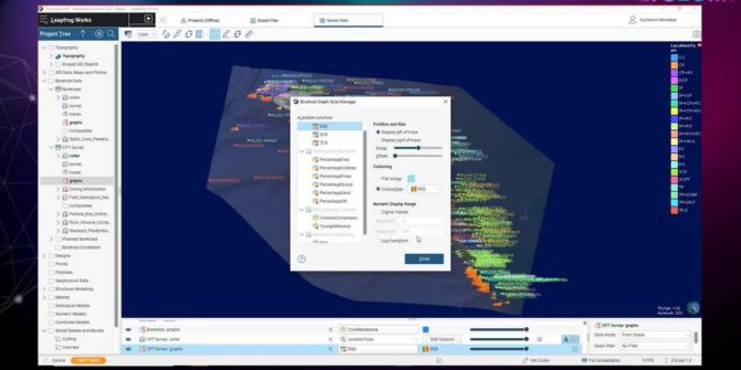
Using Indicator Kriging to quantify sub surface risk in the design of monopiles for offshore wind turbines
This project uses borehole data from an offshore windfarm and during the session we will go through the steps to create an Indicator Kriged block
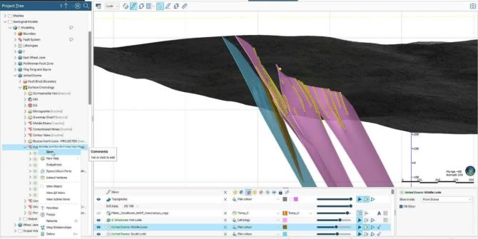
Unconventional vein system modelling to reduce exploration risk and enhance borehole targeting
This presentation will explain how to import analogue data, digitise it using polylines and vein systems to create an accurate geological model, and show how
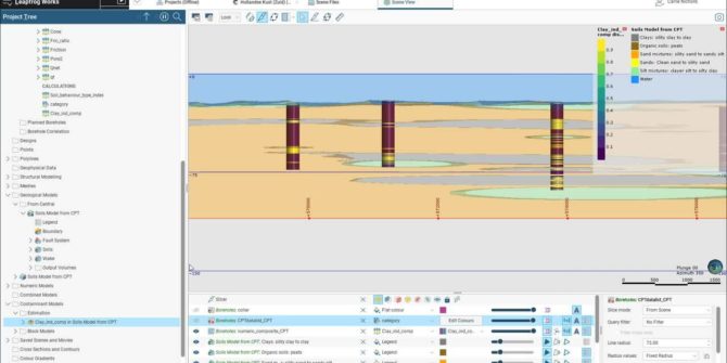
Three Successful workflows to use when incorporating borehole data from OpenGround into Leapfrog Works
Attendees will discover techniques to use Leapfrog Works to visualise and understand all the data within the borehole.
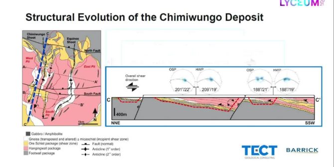
Implicit structural modelling and domaining of intensely sheared and foliated basement complex at Lumwana Mine, Zambia
Which was carefully interpreted in Leapfrog Geo to create a series of block-faulted ductile, tectono-stratigraphic domains and internal structural form interpolants that encompass an intensely