


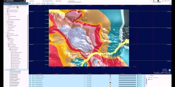
Rendered Maps and Title Blocks with Leapfrog Works
Within this short webinar, Richard will explain how new features within Leapfrog 2023.2 have enhanced this process, focusing on: New features allowing for creation of

Groundwater: The Lifeline of Global Communities and Economies
On World Water Day 2024, Seequent underscores the critical role of groundwater in sustaining life and economies globally. Our infographic delves into the unseen yet
GeoStudio Answer Hour: New Features in GeoStudio
GeoStudio 2024.1 continues to build on Seequent’s geotechnical analysis solution, with the addition of many new SLOPE3D features. This release also advances the 3D geometry
The future of groundwater is digital
The question isn’t whether we need to act – it’s how quickly we can scale solutions that work. And here’s the good news: water isn’t
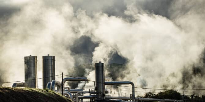
Harnessing low temperature geothermal fields in the urban area of Reykjavík, SW-Iceland: tackling challenges with 3D modelling
Since the 1930s the utilisation of low temperature geothermal fields in Iceland has greatly improved the inhabitants’ life quality and completely transformed capital city. The

Resource ready estimates – Tricks you might not know
Leapfrog Edge is a module that extends Leapfrog's dynamic workflow, offering built-in tools for comprehensive resource estimation and validation directly within the software. Join Lee
Master the blast – Leapfrog workflows for blast hole mapping
In this webinar, we will showcase Leapfrog Geo workflows that can assist production geologists with their grade control workflows by using existing data to achieve
Is this the toughest railway project in the world?
The China-Nepal railway would be a high-altitude feat of almost inhuman engineering skill. Impossible say some. Yet 50 years after it was first mooted, a