


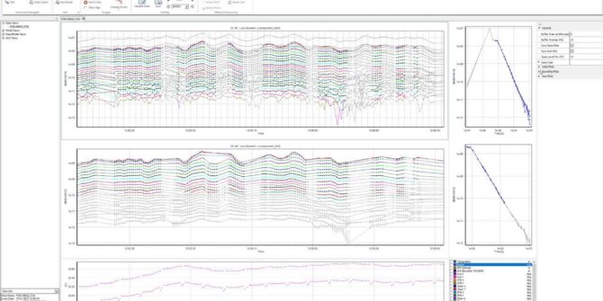
Aarhus Workbench 6.6: New data visualisation capabilities with “Views”
Views is a flexible, visual tool for processing and visualization of all EM and streamed ERT data in Workbench. Depending on your workflow and what

Mollusks, levies, and earthquakes: A map of Mississippi’s aquifers answers unexpected questions
One of the largest groundwater surveys in the USA is also answering unexpected questions about infrastructure, habitats, and some yet to be asked.
Facilitating groundwater flow and solute transport modelling with Leapfrog Works
This webinar recording will showcase the relationship between geological models, groundwater flow and solute transport modelling. Learn how to create, edit and export a MODFLOW
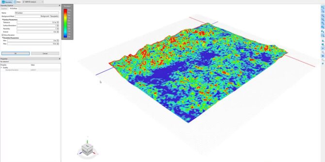
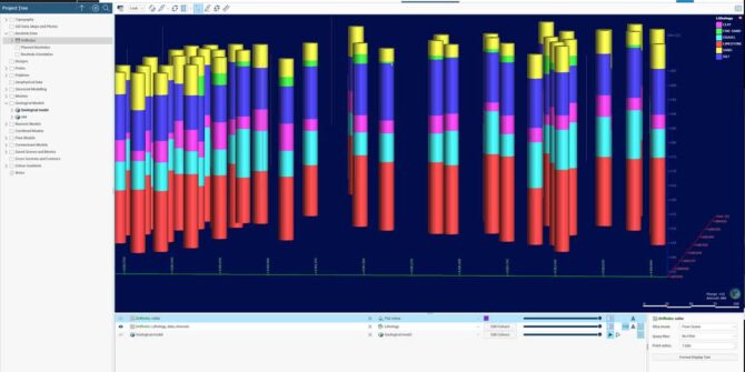
Mastering 3D Analysis: Working with Imported Geometry in BUILD3D
There are various options available for geometry creation, including importing geology or topography from external sources, including Leapfrog geological models through Seequent Central. This video
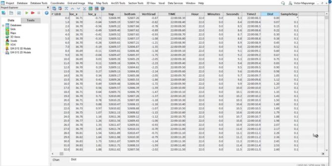
Using the Channel Math Tool to QC geophysical datasets in Oasis Montaj
In this video we show how the user can use the Channel Math tool to calculate sample separation, velocity and heading for the purposes of
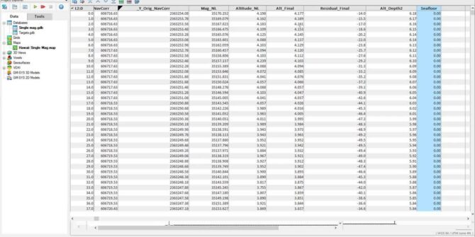
Survey Coverage tool in the UXO marine extension
Using the sensor footprint at the seafloor, and the sensor altitude, easily determine what percent of the survey area has been surveyed and visualise this

Eric Bugeja, buildingSMART Discusses IFC Interoperability with Pat McLarin, Seequent
In this interview, Pat McLarin, Civil Segment Director at Seequent interviews Eric Bugeja, Chairman, Australasia at buildingSMART to discuss the new initiatives designed to improve
Leapfrog Works Refresher
New to Leapfrog Works or wanting to refresh on the basics? Join us in this instructor-led session to help you get going with Leapfrog. The