


From data complexity to decision clarity
How a simplified decision-making model can clear the path to data management best practice. The 2021 Geoscience Data Management Report tells us that every business has their own data management approach and challenges. At Seequent

DHI Consultants Present: Transforming project outcomes using Leapfrog and FEFLOW simulation for groundwater flow models
With thirteen years’ experience as a hydrogeologist involved in a variety of hydrogeological, geotechnical and geothermal projects in Germany, Peru and Western Australia, Ferdinand will
Connecting the unconnected – Seequent Solutions for Civil & Environmental Projects
We are digitizing the world around us. The amount and types of environmental and engineering data that we now collect about the earth and infrastructure
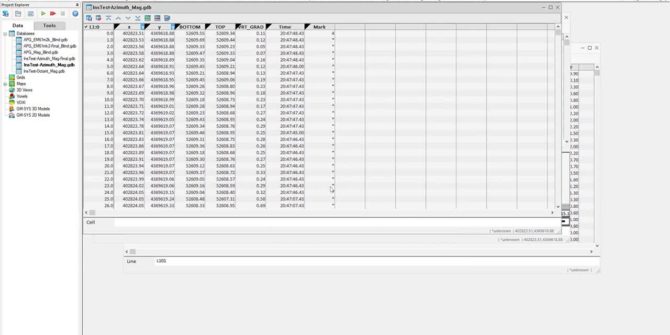
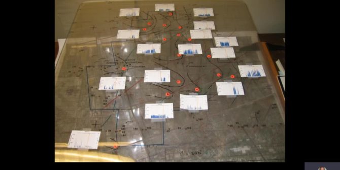
UXO Land Quality Control
UXO Land QC Heading corrections Sample separation Velocity Footprint coverage Heading corrections Instrument tests: Azimuth test: operator rotates around a magnetic sensor Octant test: operator
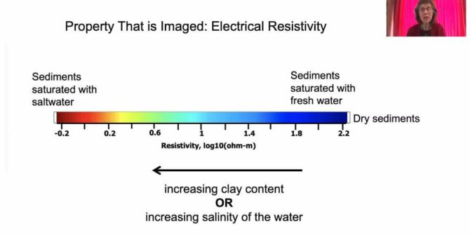
Mapping the groundwater systems of California with airborne geophysics
Discover how geophysical imaging methods have a critical role to play in mapping groundwater systems, providing information that could never be acquired through the drilling
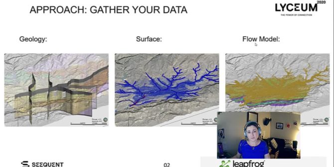
Connecting to water above and below: Using Leapfrog Works to communicate complex surface and groundwater interactions
Water purveyors are responsible for ensuring that water management practices protect the communities and ecosystems that depend on surface water and groundwater systems to sustain
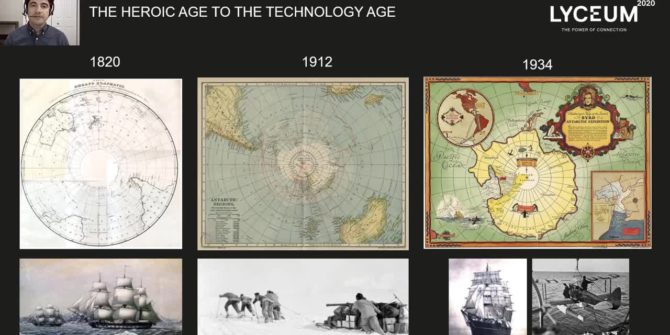
Sea level rise from Antarctica’s enigmatic submarine basins and the global, multidisciplinary effort to understand them
Antarctica has been explored for commercial gain and as a natural wonder. Recently, satellites have revealed an ice sheet vulnerable to climate change, exposing a
How conceptual site models summarise and communicate subsurface conditions for environmental cleanup
Discover the 30-year journey developing CSMs for contaminated sites, focusing on work flows to summarise and communicate the essential elements of the subsurface.