


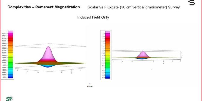
Magnetic Surveying for anthropogenic objects: The theory
The theory, data acquisition and data processing. The webinars are jointly delivered by Seequent and Geometrics. Search for man-made objects in the near surface has
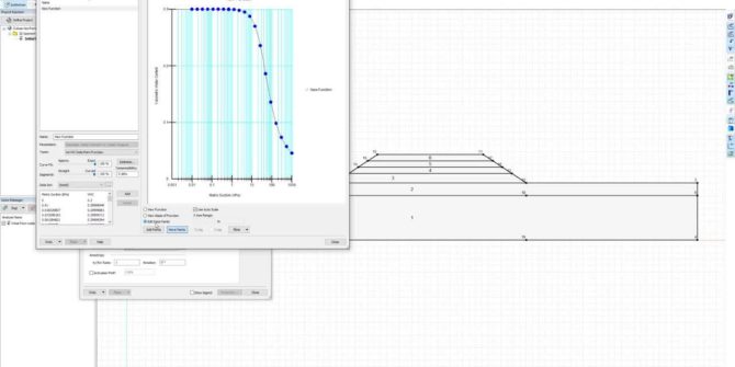
GeoStudio Core: Integrating SLOPE/W, SEEP/W, and SIGMA/W to solve more complex problems
This video will take you through the step-by-step process of defining the analysis tree, materials, and geometry, followed by reviewing the results of an example
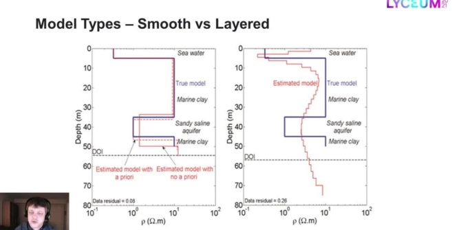
Model types for the inversion of TEM/FEM data in Aarhus Workbench
Most inversions are done with smooth models only, but often the resolution is good enough to sense more abrupt changes in the geology than the
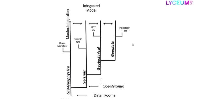
A central case study: Multi-disciplinary approach to managing big data for offshore windfarm development
This presentation explores strategic approaches for overcoming common challenges associated with modelling large multi-disciplinary datasets for offshore windfarm development.
Net Zero by 2050: The role of geoscience and engineering in meeting decarbonisation goals
This panel will discuss how geoscientists and engineers support many decarbonization initiatives and the broad range of renewable energy sources (geothermal, wind turbines, solar, tidal,
Welcome address: Graham Grant | Together (with BSY) Towards Tomorrow! Greg Bentley | Keynote: Can geoscience save the world? Professor Chris Jackson
Together (with BSY) Towards Tomorrow! from Greg Bentley, CEO, Bentley Systems. Greg shares his perspective on advancing infrastructure and the importance of the subsurface through
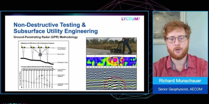
The value of adding geophysics to your infrastructure and environmental projects
It is cost effective, for the amount of data it supplies, non-intrusive and environmentally friendly, it reduces risk, and increases insight about the subsurface.
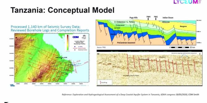
Recycling oil data to discover deep groundwater resources in water scarce countries
Ruden AS has developed an innovative method that uses existing data and technology from the oil industry, combined with applied hydrogeology to search for water