


Visualise seismic data in 3D with Leapfrog Energy 2021.1
Seismic data is a crucial geophysical method across multiple industries, but in particular is a mainstay in hydrocarbon exploration and development. As the geothermal industry
Import multiple drillhole, borehole and well data sets into your Leapfrog project
Drillhole, borehole or well data (collectively termed drill data for this blog) is at the core of every Leapfrog project. The drill data object provides
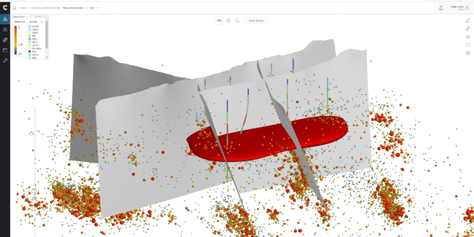
Multi-Trend Gridding for Geophysical data
We’re always looking for better ways to help you visualise your data and our brand new gridding algorithm, Multi-Trend Gridding, is specifically designed for interpolation
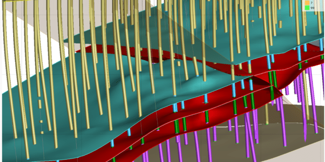
Geological modeling with drillholes + What’s new in Geo (Remote Roundup 2021)
Geological units to be modeled include an erosional surface, a vein system, and 2 diorite intrusions. Wrap up the demo with a tour of the
Experience 40-70% reductions in drillhole loading with Leapfrog
Our drillhole database has always been far more than just an organised collection of data, stored and accessed through Leapfrog. From the beginning, the database
Engaging a wider audience just got easier with Central’s public sharing
Central allows you to build a better connection with your project team and create collaborative modelling workflows in the cloud. However, when it comes to
The Parameter Report – Leapfrog Edge’s new tool for simpler visual validation and organisation
First launched in December 2018, Leapfrog Edge is an intuitive and highly visual estimation module for today’s resource estimation challenges. Unique to Edge, the resource
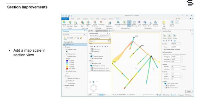
Target for ArcGIS Pro 2.2 – Enhancements for better visualization and interpretation of drillhole data
This webinar is the best place to learn how the new functionalities can improve efficiency in your workflows, give you more flexibility and help you