


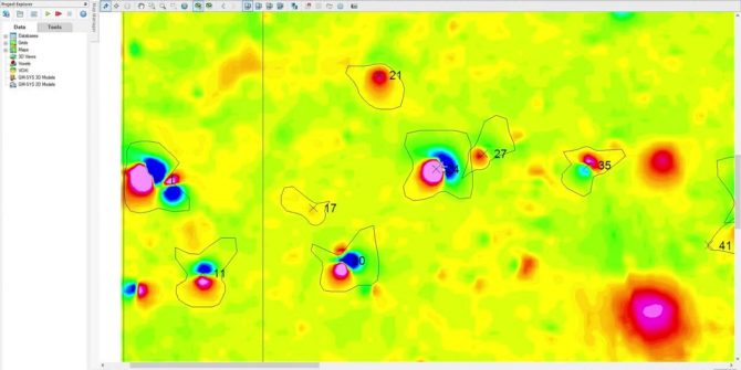
UXO Target Analysis
Target Analysis Creating and editing target polygons Model targets for depth Duration 9 min JTNDJTIxLS0lMjBUaGUlMjBzY3JpcHQlMjB0YWclMjBzaG91bGQlMjBsaXZlJTIwaW4lMjB0aGUlMjBoZWFkJTIwb2YlMjB5b3VyJTIwcGFnZSUyMGlmJTIwYXQlMjBhbGwlMjBwb3NzaWJsZSUyMC0tJTNFJTBBJTNDc2NyaXB0JTIwdHlwZSUzRCUyMnRleHQlMkZqYXZhc2NyaXB0JTIyJTIwYXN5bmMlMjBzcmMlM0QlMjJodHRwcyUzQSUyRiUyRnBsYXkudmlkeWFyZC5jb20lMkZlbWJlZCUyRnY0LmpzJTIyJTNFJTNDJTJGc2NyaXB0JTNFJTBBJTBBJTNDJTIxLS0lMjBQdXQlMjB0aGlzJTIwd2hlcmV2ZXIlMjB5b3UlMjB3b3VsZCUyMGxpa2UlMjB5b3VyJTIwcGxheWVyJTIwdG8lMjBhcHBlYXIlMjAtLSUzRSUwQSUzQ2ltZyUwQSUyMCUyMHN0eWxlJTNEJTIyd2lkdGglM0ElMjAxMDAlMjUlM0IlMjBtYXJnaW4lM0ElMjBhdXRvJTNCJTIwZGlzcGxheSUzQSUyMGJsb2NrJTNCJTIyJTBBJTIwJTIwY2xhc3MlM0QlMjJ2aWR5YXJkLXBsYXllci1lbWJlZCUyMiUwQSUyMCUyMHNyYyUzRCUyMmh0dHBzJTNBJTJGJTJGcGxheS52aWR5YXJkLmNvbSUyRmJxdHBUOVk0d3RMZUFTeGZya1oxR0cuanBnJTIyJTBBJTIwJTIwZGF0YS11dWlkJTNEJTIyYnF0cFQ5WTR3dExlQVN4ZnJrWjFHRyUyMiUwQSUyMCUyMGRhdGEtdiUzRCUyMjQlMjIlMEElMjAlMjBkYXRhLXR5cGUlM0QlMjJpbmxpbmUlMjIlMEElMkYlM0UlMEElMEE= Video Transcript The video transcript gets copy and pasted here
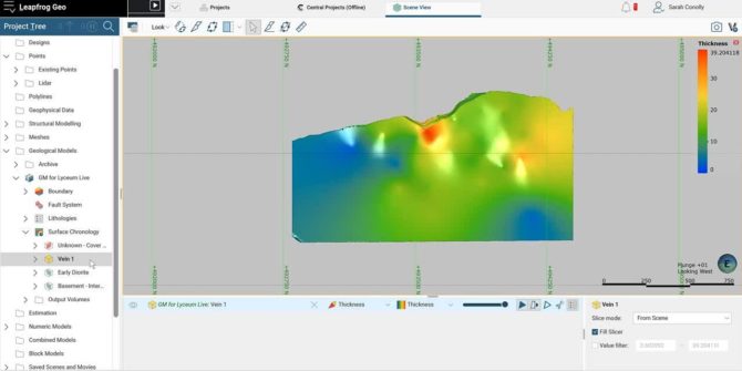
Grade-Thickness Contouring in Leapfrog Geo
Goal Create a model to contour grade-thickness across a vein or other tabular volume modelled in Leapfrog Geo. Workflow Create a numerical model for grade
Target for ArcGIS Pro WebScene
Learn about Target for ArcGIS Pro WebScene How to share a drillhole project created using Target for ArcGIS Pro as an Esri web scene Visualise
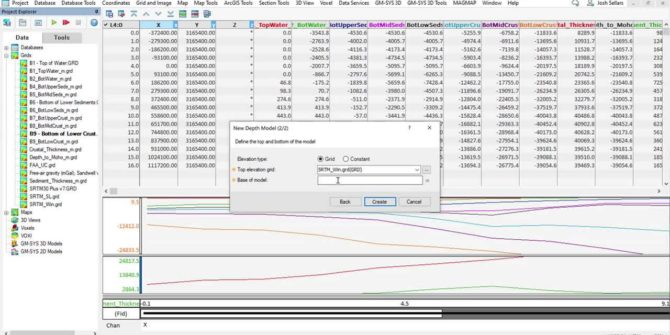
Region Model Building using Public Data in GM-SYS 3D
Overview Define model area Extract Crust 1.0 horizons using Data Services tools Adding layers to your GM-SYS 3d model Assigning physical properties Working with outputs
UAV Survey
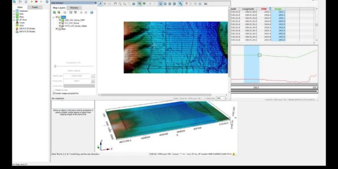
How to plan an unmanned aerial vehicle (UAV) magentic survey Define survey Defining sub-areas Creating a drape elevation Visual line of sight test (VLOS) Duration15
UXO Land Quality Control
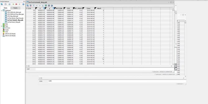
UXO Land QC Heading corrections Sample separation Velocity Footprint coverage Heading corrections Instrument tests: Azimuth test: operator rotates around a magnetic sensor Octant test: operator
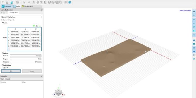
STL Geometry Creation
Connecting BUILD3D to CAD and scanned geometries STL files Triangulated mesh describing surface of 3d object Often overly complex, overly samples, or poorly meshed BUILD3D