


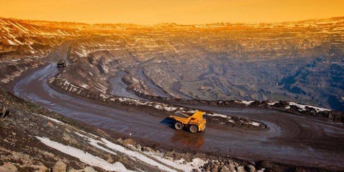
5 ways mining projects use resistivity models to reduce risks
Mining is high risk at every stage: you must find the minerals, safely and efficiently extract them, and ensure minimal environmental impact. Mining and exploration
Bentley Systems Announces Seequent’s Acquisition of Aarhus GeoSoftware
Enriching Subsurface Digital Twins through Electromagnetic Remote Sensing for Water, Environmental, and Infrastructure Resilience. EXTON, Pa. – July 7, 2021 – Bentley Systems, Incorporated (Nasdaq:
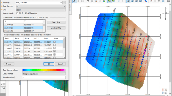
Validate your IP & Resistivity data more effectively in Oasis montaj 9.10
In the IP & Resistivity extension of Oasis montaj, you can now find more tools for enhancing visualisation of electrical data from IP surveys. Discover
The Journey to Digital Transformation for Industrial Minerals Companies
Industrial Minerals (IM) producers are experiencing a global innovation challenge, with many companies finding themselves navigating the impact of direct sourcing, digitisation and sustainability in
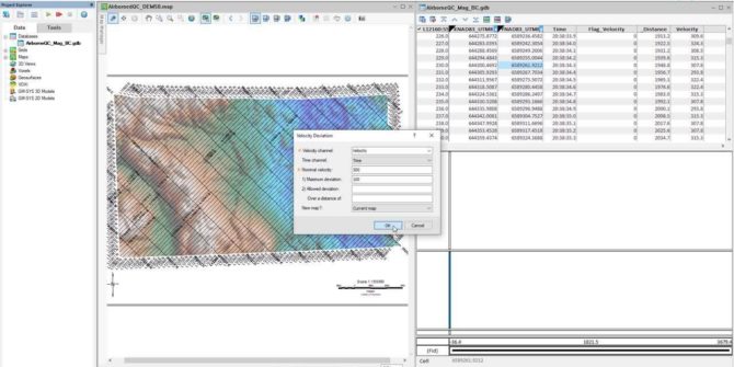
Increased confidence in your Airborne Data with Oasis montaj 9.10
The Airborne Quality Control extension for Oasis montaj allows you to design and plan airborne Geophysical surveys. In addition, you may perform industry-standard quality control
New UX-Analyze menus for a more intuitive workflow
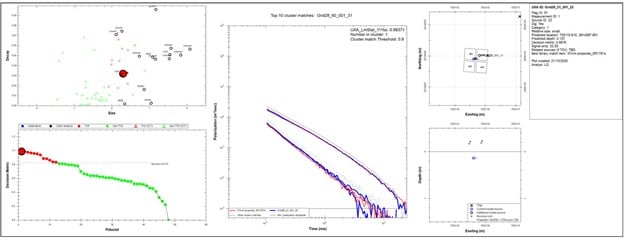
Our Advanced Geophysical Classification (AGC) workflow for unexploded ordnance (UXO) and explosive remnants of war (ERW), known as UX-Analyze, has been used by industry professional

GeoStudio Integration Workflow
1. Analyse slope stability using piezometric lines with SLOPE/W Use SLOPE/W to do a simple global stability analysis using a piezometric line to model pore-water
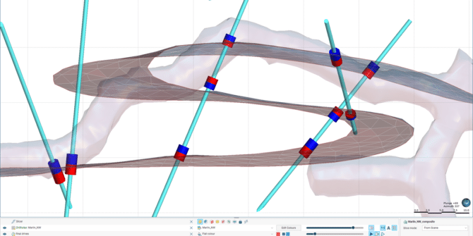
Modelling complex vein geometries in Leapfrog 2021.1
Improvements to the vein modelling tool make this tool stronger than ever. Leapfrog’s vein modelling tool was an industry first in bringing power and ease