


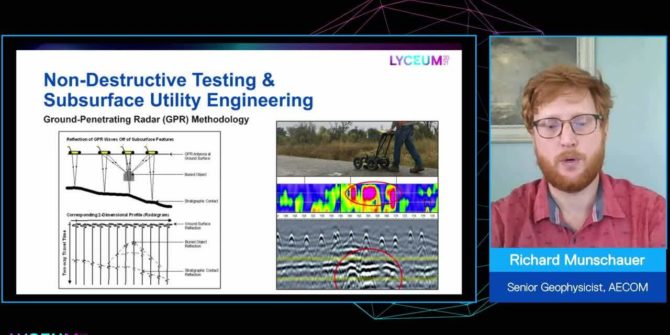
The value of adding geophysics to your infrastructure and environmental projects
It is cost effective, for the amount of data it supplies, non-intrusive and environmentally friendly, it reduces risk, and increases insight about the subsurface.
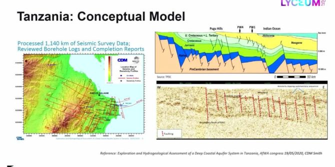
Recycling oil data to discover deep groundwater resources in water scarce countries
Ruden AS has developed an innovative method that uses existing data and technology from the oil industry, combined with applied hydrogeology to search for water
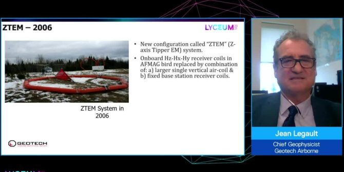
Showcasing 20 years of technology advancements of the ZTEM natural field EM system
This session will be speaking about the ZTEMTM (z-axis tipper electromagnetic) airborne passive EM mapping system, which is widely accepted as a key tool in
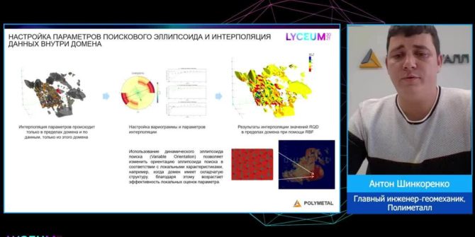
Geomechanical modelling as part of a digital mine
The geomechanical model can and should become the main tool of geomechanical engineers for identifying potentially dangerous areas and 3D calculations of different rock mass
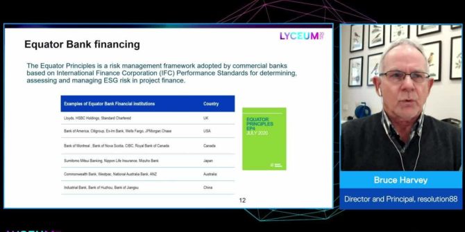
Trust, but verify: Remote sensing for ESG assurance in resource sector financing
Environmental, social and governance (ESG) is increasingly referenced in corporate boardrooms and the financial sector, and verification of ESG metrics is a new condition of
How drones are evolving the way we explore the Earth
As drones and survey instruments become lighter and batteries become stronger, innovative ways to apply drone technology is evolving rapidly.
Solving the groundwater challenge
Access to safe water and sanitation is the pivotal point that turn problems into potential by empowering people with time for school and work and
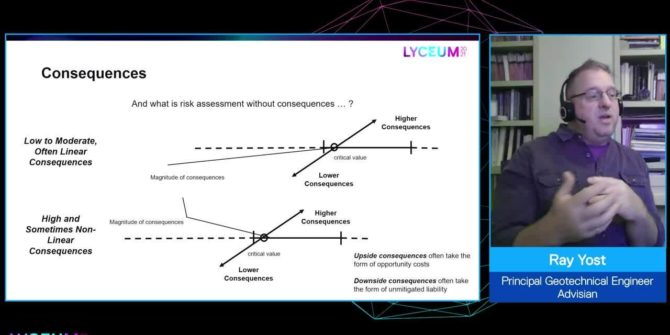
Understanding geotechnical risk: A structure for uncertainty
This session presents a means to characterize risk as a function of the relationship between uncertainty - provides divisions to the continuum of tools available