


UAV Survey
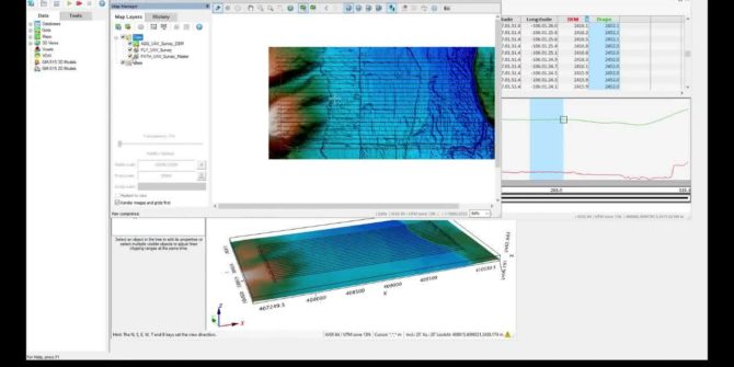
How to plan an unmanned aerial vehicle (UAV) magentic survey Define survey Defining sub-areas Creating a drape elevation Visual line of sight test (VLOS) Duration15
UXO Land Quality Control
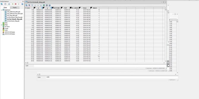
UXO Land QC Heading corrections Sample separation Velocity Footprint coverage Heading corrections Instrument tests: Azimuth test: operator rotates around a magnetic sensor Octant test: operator
STL Geometry Creation
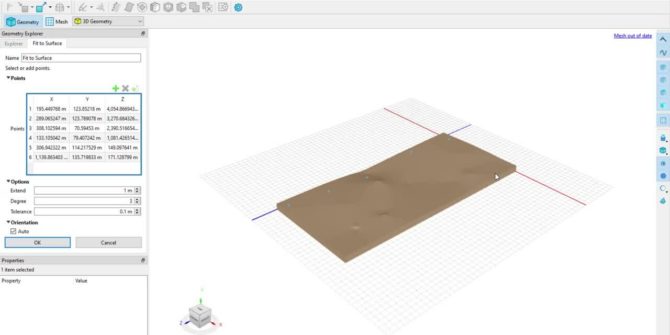
Connecting BUILD3D to CAD and scanned geometries STL files Triangulated mesh describing surface of 3d object Often overly complex, overly samples, or poorly meshed BUILD3D
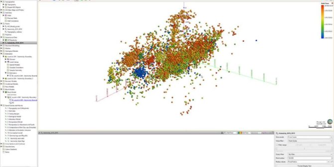
Microseismic visualisation and evaluation
Learn more about microseismic visualisation and evaluation
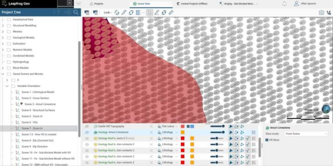
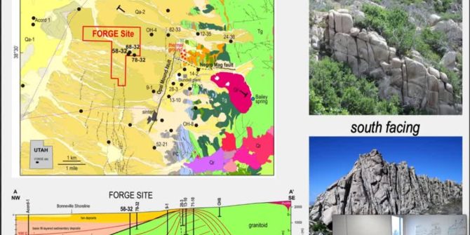
The role of earth modeling for the Utah FORGE site
To ensure quantitative comparability of simulation results, and consistent initial and boundary conditions, a framework has been developed using Leapfrog Geothermal and Central to provide
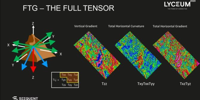
From data to Data Room
Discover how high-resolution FTG data, when combined with other data sets, can furthermore be used to de-risk plays and in prospect evaluation.